The Isthmus of Tehuantepec: Being the Results of a Survey for a Railroad to Connect the Atlantic and Pacific Oceans, Made by the Scientific Commission under the Direction of Major J.G. Barnard, U.S. Engineers. With a Resume of the Geology, Climate, Local Geography, Productive Industry, Fauna and Flora, of the Region; Maps Illustrating the Isthmus of Tehuantepec [Louisiana] - 2 volumes
- Hardcover
- New York: D. Appleton & Company, 1852
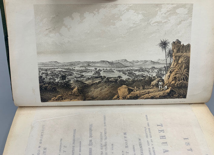
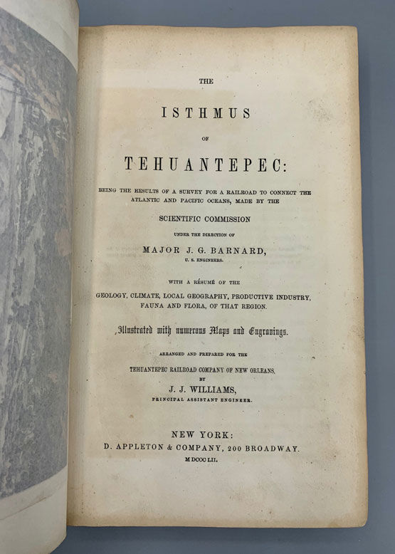
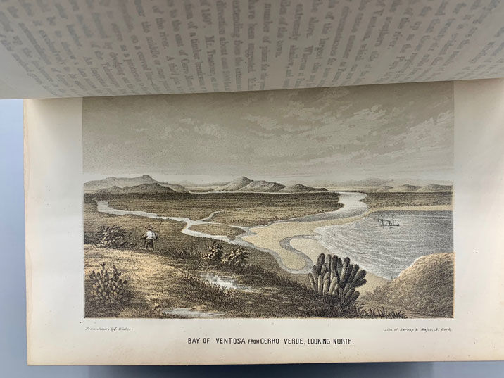
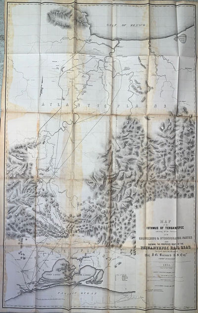
New York: D. Appleton & Company, 1852. First edition. Hardcover. Good +. Text and map volumes. 295pp. Octavo [23.5 cm] in original blind-embossed green cloth. Rebacked, with most of original backstrip overlaid. Several small ink stains to boards and spine, darkening to spine, narrow dampstain to rear board at foot, corners lightly bumped; contemporary ink ownership inscription on front free endpaper, light soiling to rear endpaper, toning and light foxing to margins, else interior is unmarked. 15 plates (14 of which are hand-tinted) with tissue protectors, folding B&W map of inter-oceanic routes, folding diagram. The accompanying maps are laid in loosely between embossed and gilt stamped boards. The maps are darkened in areas, and have periodic splits along the folds, the longest splits measure approximately 6". Complete, with the following maps present. Map of the Isthmus of Tehuantepec embracing all the Surveys of the Engineering & Hydrographic Parties and Shewing the Proposed Route of the Tehuantepec Railroad Surveyed Under the Direction of Maj. J. G. Barnard U.S. Eng., Chief Engineer. (Lith. of Sarony & Major, New York) / Plan of that part of the Isthmus of Tehuantepec, between the Jaltapec River and the Pacific Plains; Embracing all of the Engineering Difficulties on the Route of the Survey / Mouth of the Coatzacoalcos River Surveyed Jan. 1848 by order of Com. M.C. Perry / Sketch from the Mouth of Coatzacoalcos River, to the Town of Mina-Titlan, made by order of Commodore M.C. Perry / 1851 Tehuntepec Survey. Major J. G. Bnard U.S.A. Engineer in Chief. Map of the Coatzacoalcos River. From Mina-Titlan to the Isla del Suchil. And of the Jaltepec River. From Its Junction to the Railroad Crossing. Surveyed by the Hydrographic Party, under the Command of Wm. G. Temple / Tehuantepec Survey, Maj. J. G. Barnard U. S. A., Engineer in Chief. Map of the River Uspanapa, to the Playa del Tigre. Made in May 1851 by J. Mc. L. Murphy U. S. N. Hydrographic Assistant / Chart of the Ports of Laventosa & Salina Cruz according to the survey made in December of 1850. For the Tehuantepec Rail Road Company New Orleans. By Their Engineer P. E. Trastour / Chart of the Entrance and Channel of the Boca-Barra According to the Survey made in November 1850 for the Tehuantepec Rail Road Company of New Orleans by Their Engineer P. E. Trastour (Lith. of Endicott & Co., N.Y.).