Report of the United States Geological Exploration of the Fortieth Parallel Made by Order of the Secretary of War According to Acts of Congress of March 2, 1867, and March 3, 1869, Under the Direction of Brig. and Bvt. Major General A. A. Humphreys, Chief of Engineers, By Clarence King, U. S. Geologist (Volumes I-VII); Atlas Accompanying Volume III on Mining Industry

- Hardcover
- Washington, D.C.: Government Printing Office; Julius Bien, 1880
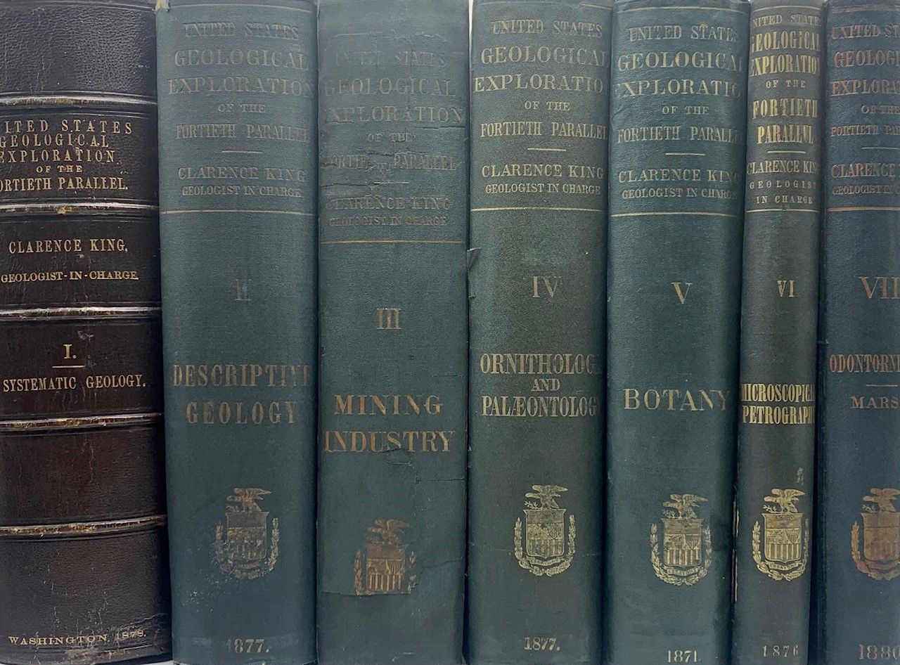
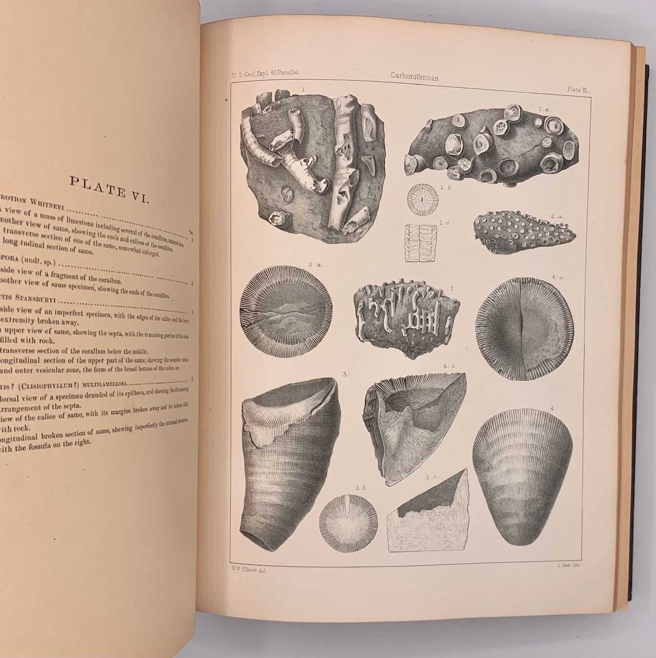
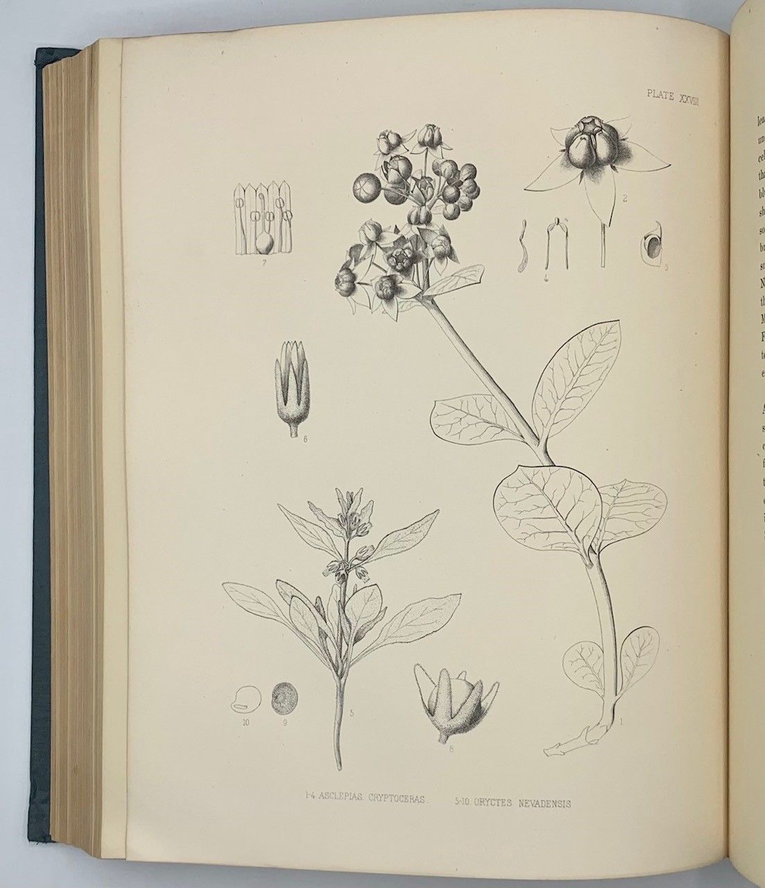
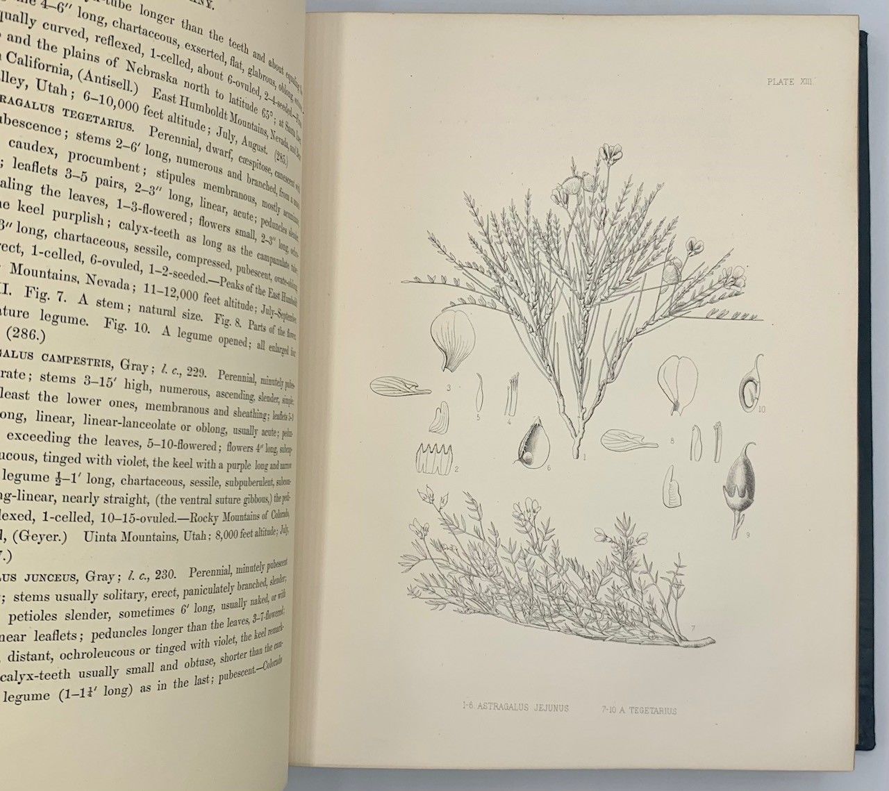
Washington, D.C.: Government Printing Office; Julius Bien, 1880. First edition. Hardcover. Very good. Julius Bien. Professional Papers of the Engineer Department, U. S. Army. No. 18. Seven volumes plus one atlas. Does not have the general atlas. Quarto [30 cm] Volume 1 is bound in 3/4 leather (with some additional skillful restoration work to the binding and new endbands). The remaining volumes are in the publisher's original green cloth. Volume 3 once belonged to The Long Island Historical Society (with deaccession stamp on title page). Volumes 4 and 7 have been professionally rebacked, and the hinges of volume 7 have been expertly reinforced. The spine of volume 6 has been skillfully restored at the spine ends and along the joints. This volume also has new endbands and Japanese tissue has been applied to the rear hinge. Overall the set shows moderate wear to the spine and boards. The wear at the extremities includes occasional chipping to the cloth and periodic exposure of the underlying boards. There are only very sporadic cracks in the text blocks. Internally very good with plates having little or no foxing. Several pages have small ink stamps from private clubs and booksellers. Volumes include: Vol. I: Systematic Geology by Clarence King (1878); Vol. II: Descriptive Geology by Arnold Hague and S. F. Emmons (1877); Vol. III: Mining Industry by James D. Hague (1870); Vol. IV: Paleontology and Ornithology by Meek, Hall, Whitfield, and Ridgway (1877); Vol. V: Botany by Sereno Watson, et al., (1871); Vol. VI, Microscopical Petrography by Ferdinand Zirkel (1876). Vol. VII: Odontornithes: A Monograph on the Extinct Toothed Birds of North America (1880). ****The preliminary pages, including the title, are those belonging to volume 2, however this is really volume 7 (This volume opens with p. 1 of the introduction). All plates and maps are present in each volume. Plate II in volume 7 is present in duplicate. There are tiny pin-size holes in the corner margins of the plates in this volume as well.
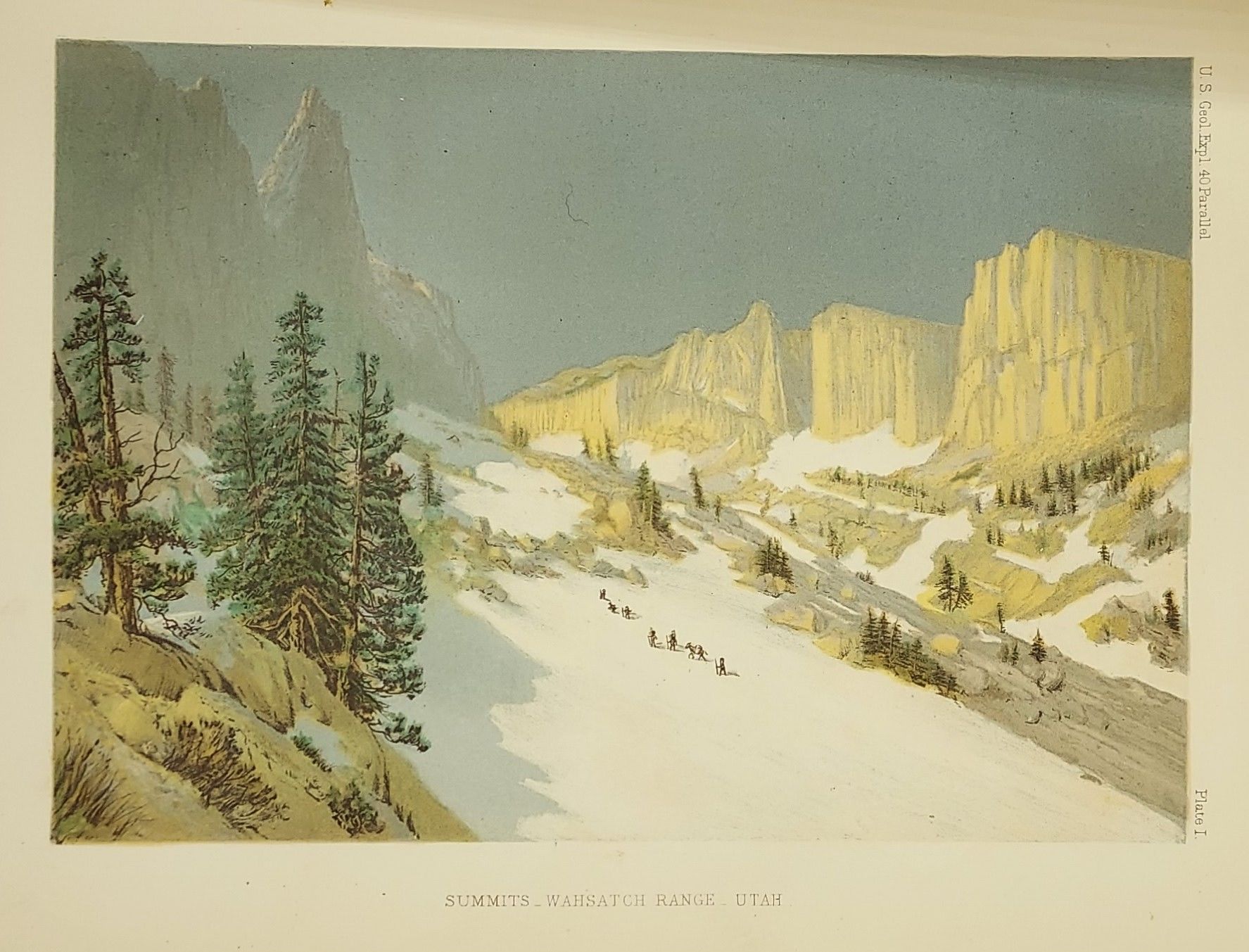
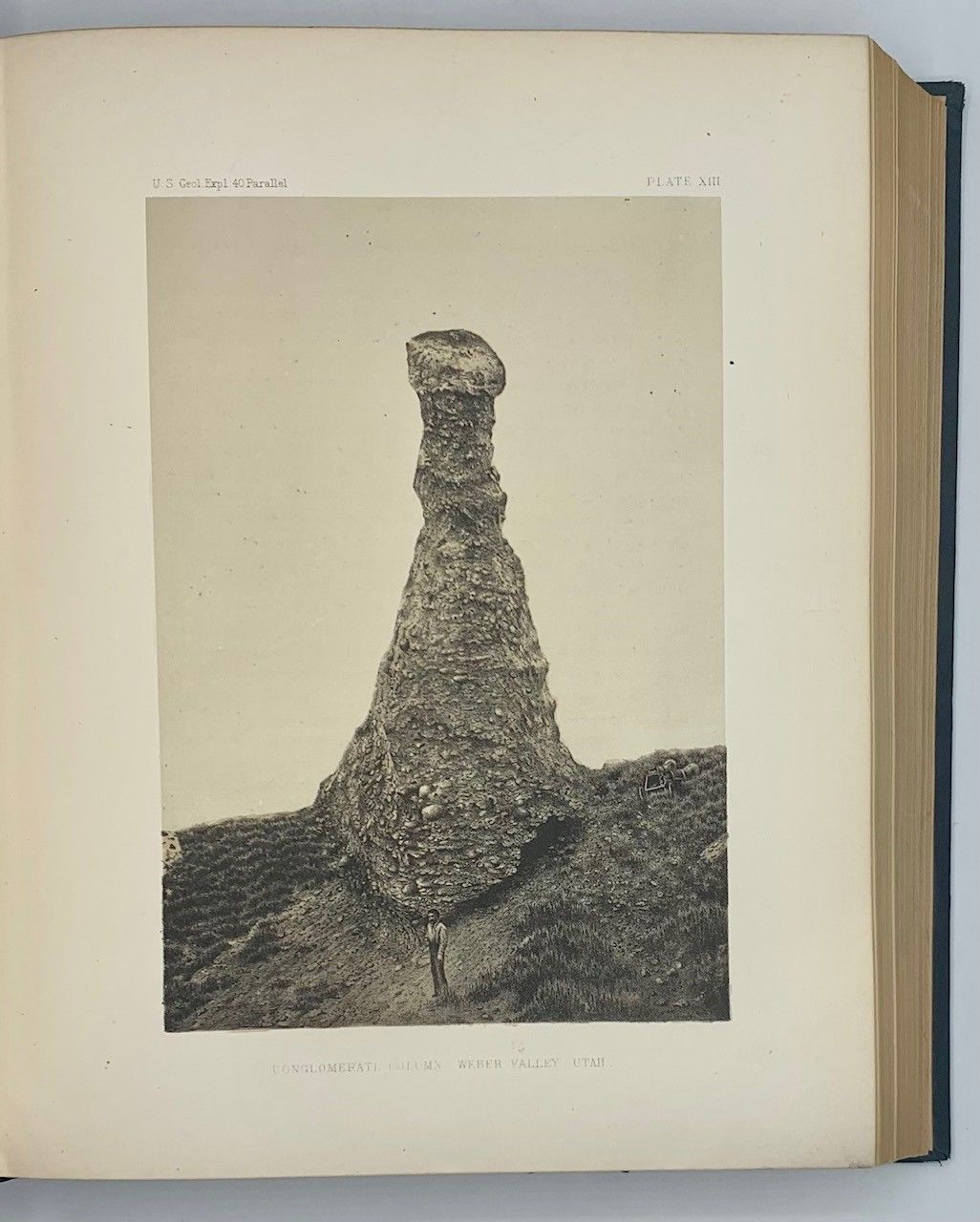
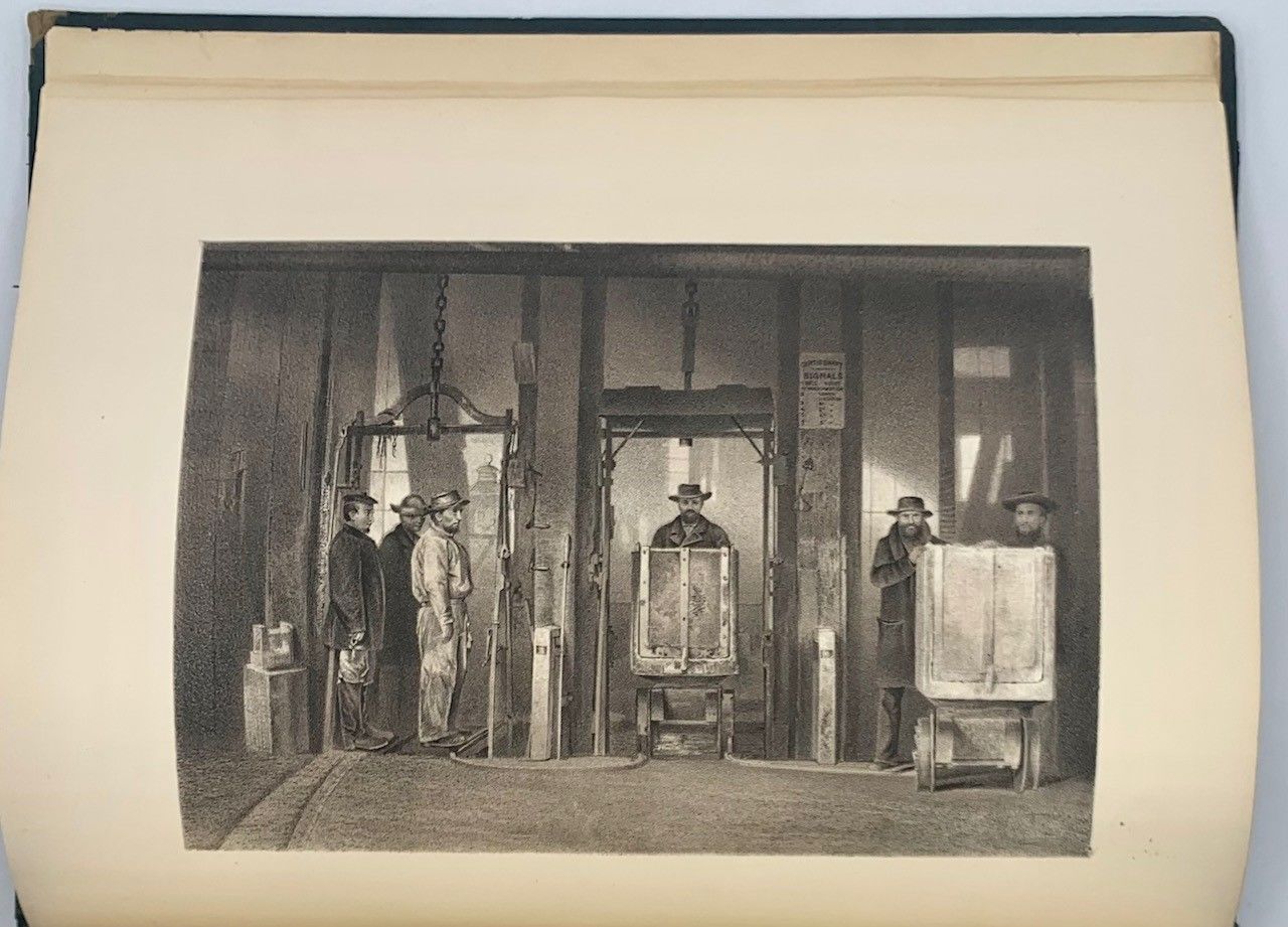
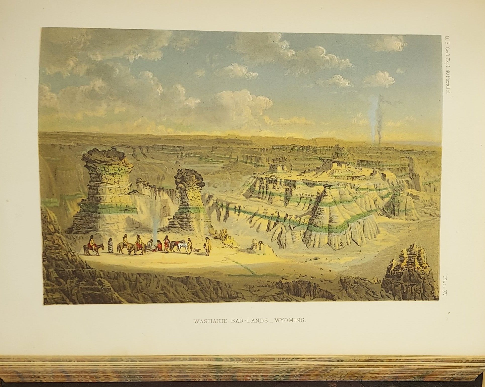
The atlas volume is an oblong elephant folio, in original 3/4 brown morocco over red-brown cloth, with cover title in gilt (1" loss from head of backstrip and scuffing to the extremities of the boards). 14 plates, all but one in color. Bartlett, Great Surveys of the American West. One of the four major geological surveys of the western United States which took place in the years following the Civil War. This early monumental survey took place in 1867, under the direction of Clarence King (1842-1901). King, a graduate of Yale's Sheffield Scientific School, was only 25 years old when he was appointed Geologist in charge of the exploration along the 40th Parallel, which spanned from Eastern Colorado to California. This expedition represented the first major attempt to map the area in detail, and was one of the first expeditions to use the medium of photography to capture images and activities of the expedition. Timothy O'Sullivan (1840-1882), known for his images of the Civil War, was the photographer for the King survey. His photographs were subsequently reproduced in lithograph form by Julius Bien for inclusion in the published volumes reporting on the expedition. Many of O'Sullivan's original photographs from the 40th Parallel expedition are now in the collection of The George Eastman House in New York. The collection represents a historically and culturally important archive depicting the American West. In 1879, the United States Geological Survey was established and appointed Clarence King its first director. In 1881, King resigned this position to pursue other scientific interests leaving John Wesley Powell (1834-1902) as his successor.
"King's Fortieth Parallel Survey materially improved the reputation of American science abroad, and set an example of accuracy and scholarship at home at a time when such an example was sorely needed. That such a survey should have taken place in an otherwise corrupt and barren era in our national life (1867-79) is also of some significance. Finally, as a personal achievement, the Fortieth Parallel Survey ranks as a project that only a man of unusual vision, talent, and tenacity could have completed." - Richard A. Bartlett (from Clarence King's Fortieth Parallel Survey, Utah Historical Quarterly Volume 24, Nos. 1-4, 1956)
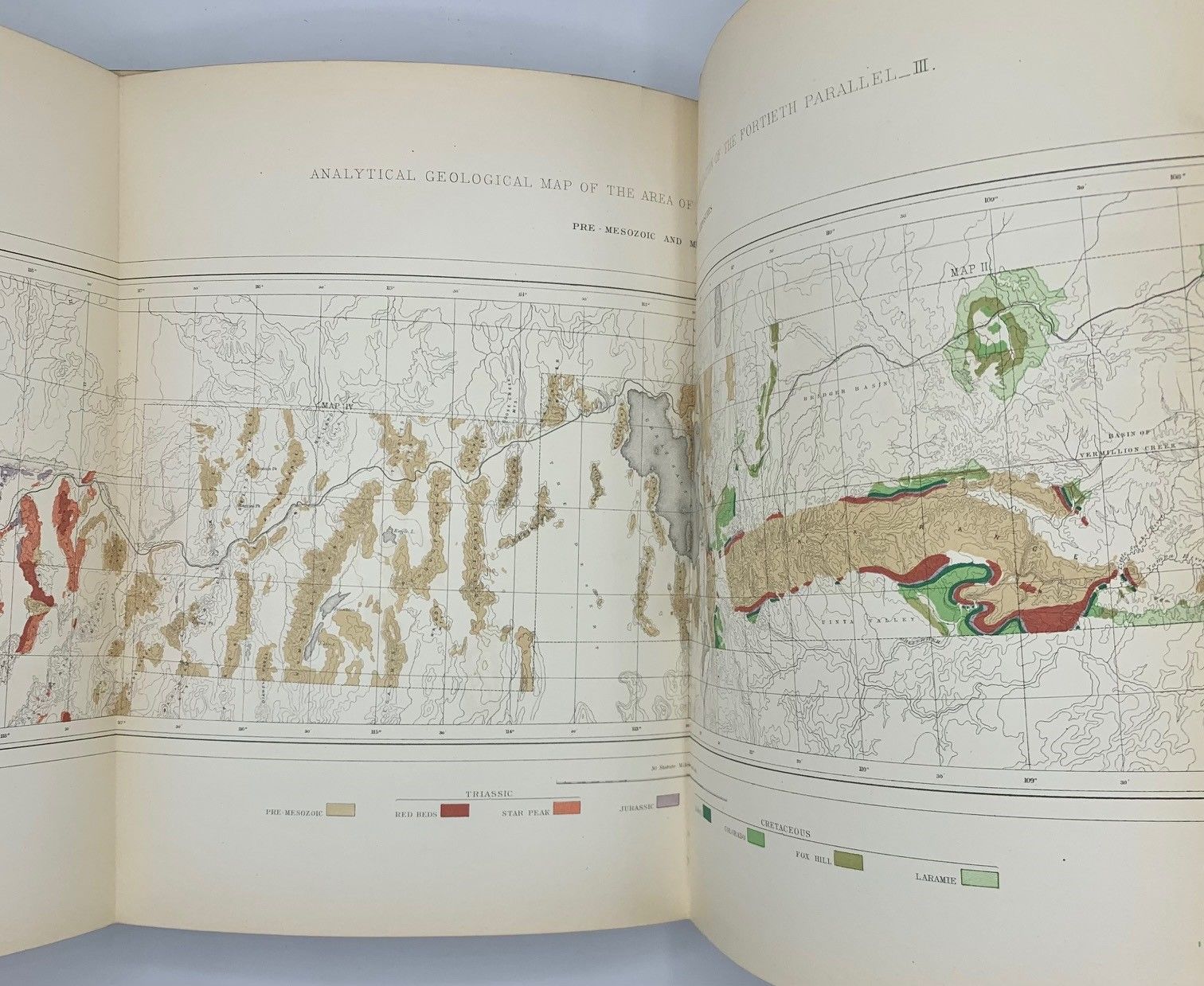
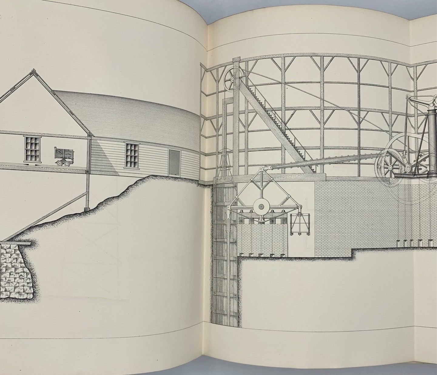
Eight volumes of this exhaustive study which examined and described the geological structure, geographical condition, and natural resources of this expanse of country located along the site of the proposed Union Pacific Railroad. One of the "Great Surveys" conducted under the auspices of the United States Government.
The atlas volume is an oblong elephant folio, in original 3/4 brown morocco over red-brown cloth, with cover title in gilt (1" loss from head of backstrip and scuffing to the extremities of the boards). 14 plates, all but one in color. Bartlett, Great Surveys of the American West. One of the four major geological surveys of the western United States which took place in the years following the Civil War. This early monumental survey took place in 1867, under the direction of Clarence King (1842-1901). King, a graduate of Yale's Sheffield Scientific School, was only 25 years old when he was appointed Geologist in charge of the exploration along the 40th Parallel, which spanned from Eastern Colorado to California. This expedition represented the first major attempt to map the area in detail, and was one of the first expeditions to use the medium of photography to capture images and activities of the expedition. Timothy O'Sullivan (1840-1882), known for his images of the Civil War, was the photographer for the King survey. His photographs were subsequently reproduced in lithograph form by Julius Bien for inclusion in the published volumes reporting on the expedition. Many of O'Sullivan's original photographs from the 40th Parallel expedition are now in the collection of The George Eastman House in New York. The collection represents a historically and culturally important archive depicting the American West. In 1879, the United States Geological Survey was established and appointed Clarence King its first director. In 1881, King resigned this position to pursue other scientific interests leaving John Wesley Powell (1834-1902) as his successor.
"King's Fortieth Parallel Survey materially improved the reputation of American science abroad, and set an example of accuracy and scholarship at home at a time when such an example was sorely needed. That such a survey should have taken place in an otherwise corrupt and barren era in our national life (1867-79) is also of some significance. Finally, as a personal achievement, the Fortieth Parallel Survey ranks as a project that only a man of unusual vision, talent, and tenacity could have completed." - Richard A. Bartlett (from Clarence King's Fortieth Parallel Survey, Utah Historical Quarterly Volume 24, Nos. 1-4, 1956)
Eight volumes of this exhaustive study which examined and described the geological structure, geographical condition, and natural resources of this expanse of country located along the site of the proposed Union Pacific Railroad. One of the "Great Surveys" conducted under the auspices of the United States Government.