Mexico, Guatemala, and the West Indies [Map]
![Mexico, Guatemala, and the West Indies [Map]](https://d3525k1ryd2155.cloudfront.net/h/116/888/1480888116.0.x.jpg)
- Map
- 1830
1830. Map. 10 1/2 x 8 1/4" [14 x 12" in mat].
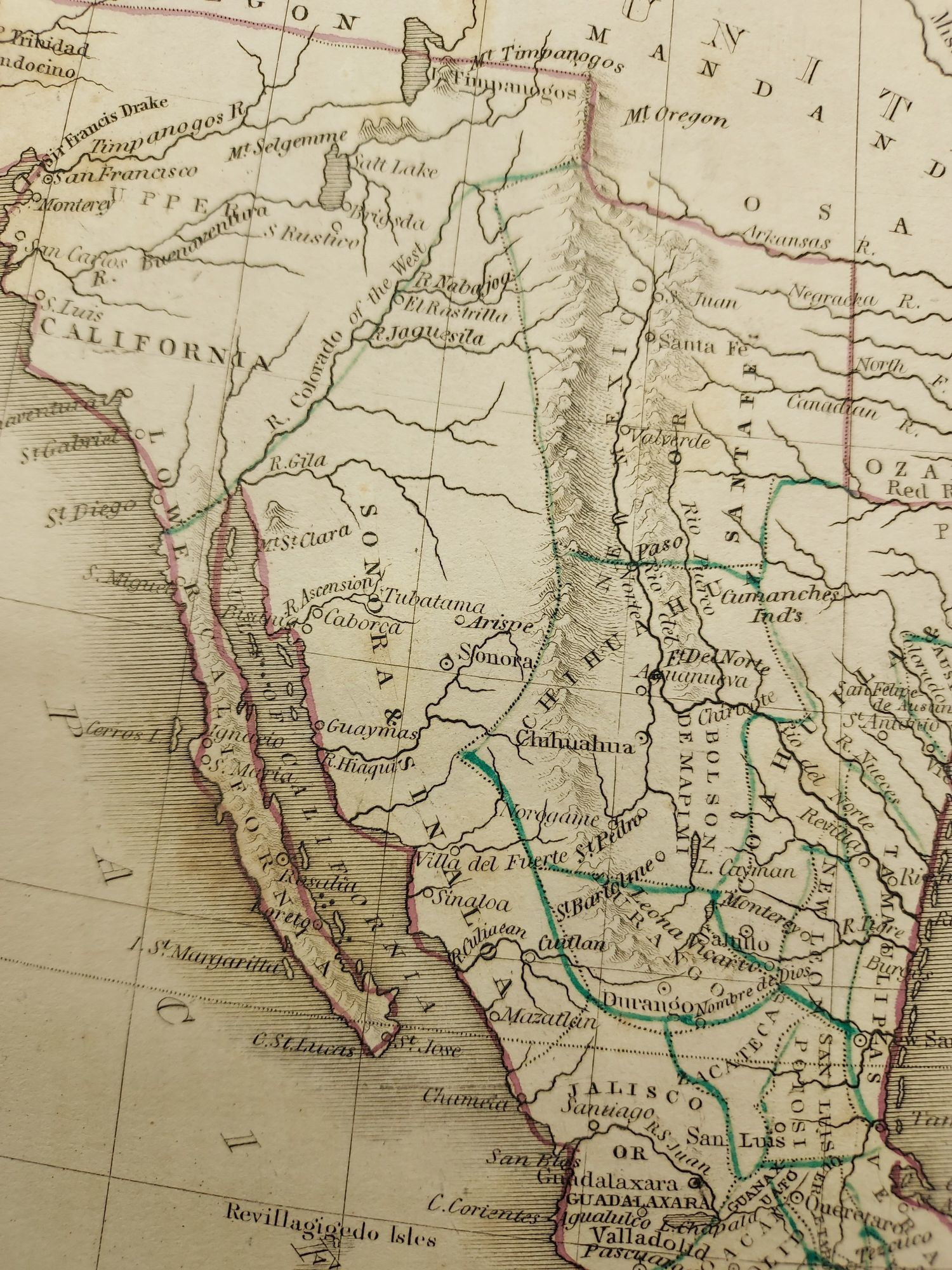
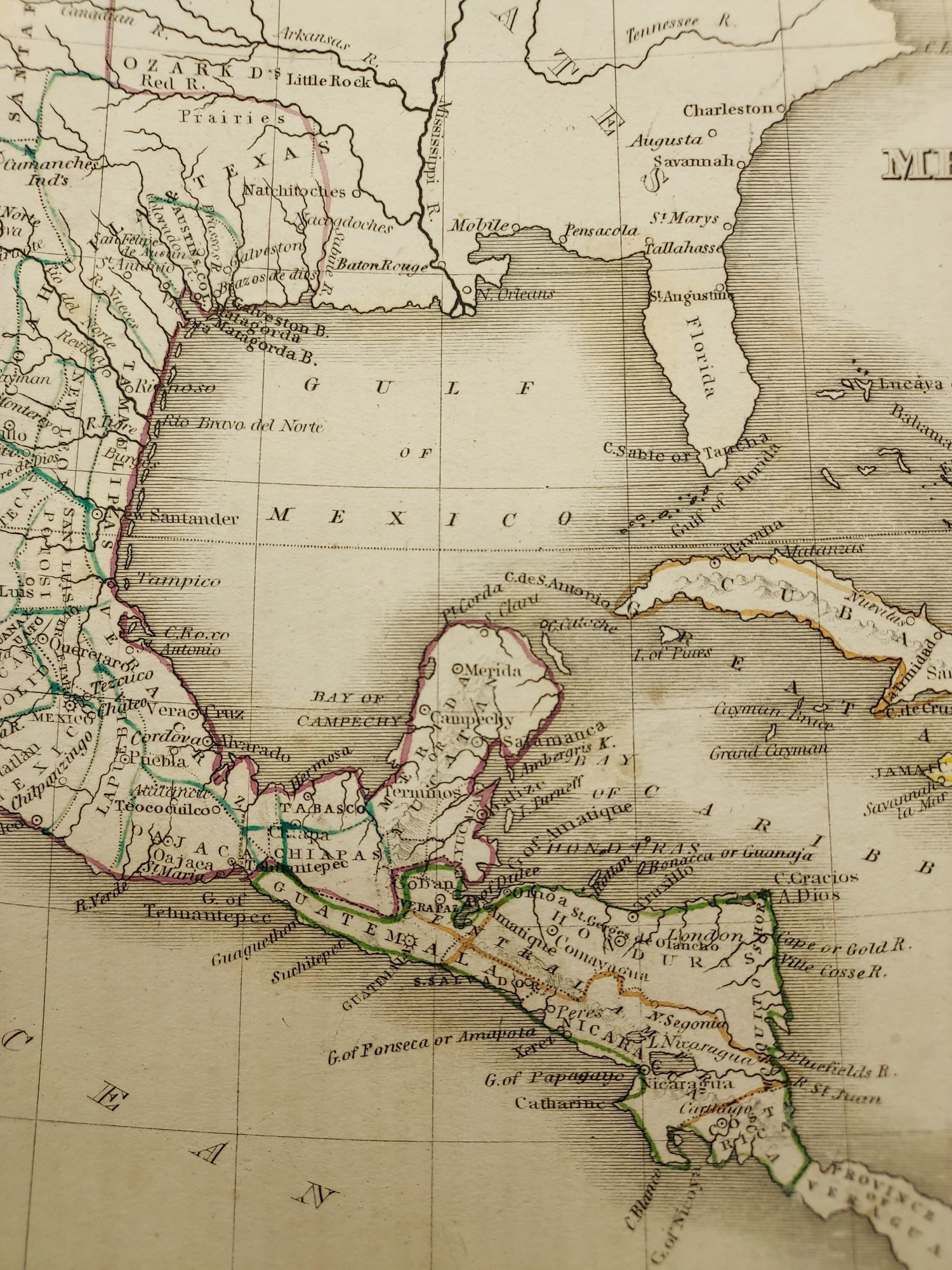
From "A Comprehensive Atlas Geographical, Historical & Commercial." American cartographer Thomas Bradford published this map shortly after the Texas Revolution, and before American settlers in Texas declared independence from Mexico. Spans from Upper California south to Panama. Mexico controls the Southwest and California, with its northern boundary extending to Oregon Territory. The Salt Lake is depicted with the odd settlement Brigsda, and is connected to the ocean via the mythical R. Buenaventura. Another lake in the Great Basin region is also charted - "Timpanogos.
From "A Comprehensive Atlas Geographical, Historical & Commercial." American cartographer Thomas Bradford published this map shortly after the Texas Revolution, and before American settlers in Texas declared independence from Mexico. Spans from Upper California south to Panama. Mexico controls the Southwest and California, with its northern boundary extending to Oregon Territory. The Salt Lake is depicted with the odd settlement Brigsda, and is connected to the ocean via the mythical R. Buenaventura. Another lake in the Great Basin region is also charted - "Timpanogos.