Johnson's Maine
- unbound
- New York: Johnson and Ward, 1863
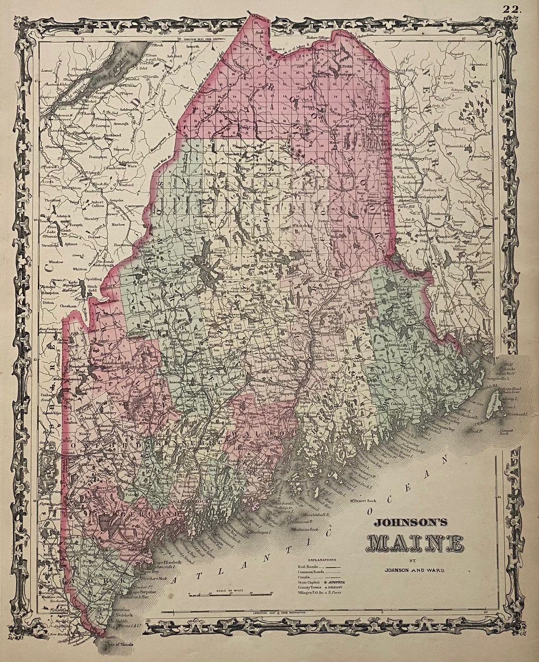
New York: Johnson and Ward, 1863. unbound. Map. Engraving with original hand coloring. Image measures 16 7/8" x 22 3/4".
Beautifully detailed double page map of Maine divided into counties and townships. Delineates towns, major routes, canals, rivers and railroads. Published in 1863, after the incorporation of Knox County in 1860, this map shows all sixteen counties of Maine. In very good condition, with minor wear to edges.
Alvin Jewett Johnson (1827-1884) is one of the most prolific American publishers of the 19th century. He opened his own company in 1856 that produced atlases, maps and encyclopedias. The company made great maps based on those by J.H. Colton, and Johnson produced a newly updated version every year up until the late 19th century.