Lithographic Map of Philadelphia and Sterlingville, New York, circa 1864
- [Philadelphia, New York , 1864
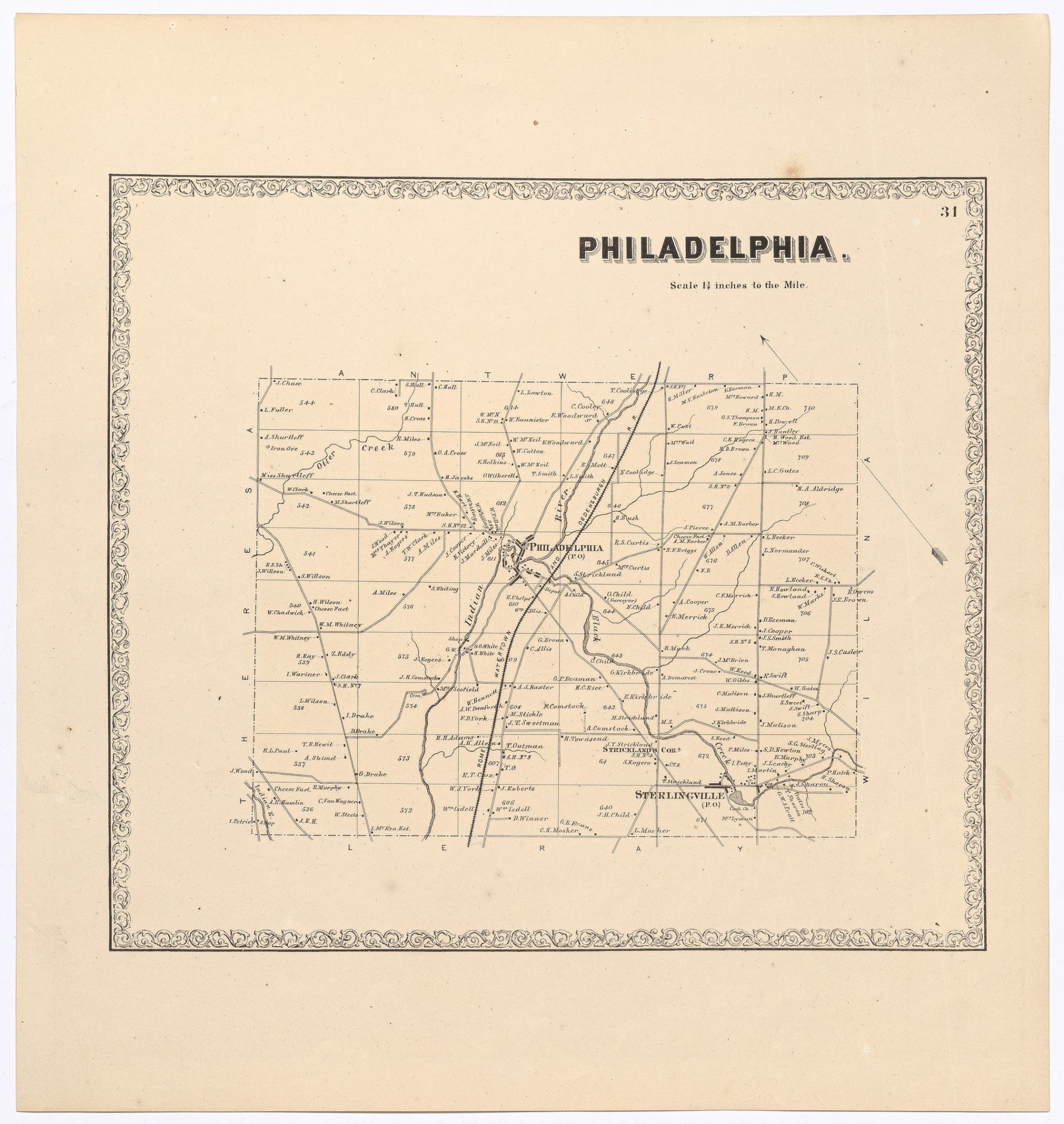
[Philadelphia, New York, 1864. Near Fine. Tinted lithographic map (15” x 16”). A few small spots, near fine. Plate no. 31, displaying the names of property owners, rivers, creeks, and railway lines in the vicinity of Philadelphia and Sterlingville in upstate New York near the Canadian border. Scarce. An attractive, well-preserved copy.