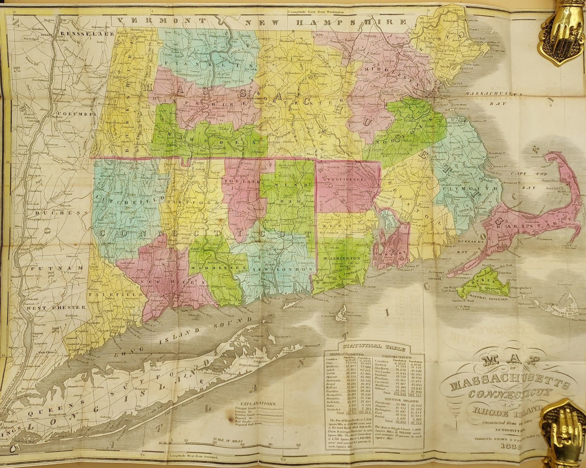
Map of Massachusetts, Connecticut and Rhode Island
- Map
- Hartford, CT: Brown & Parsons, 1838
Hartford, CT: Brown & Parsons, 1838. Map. Good. Folding pocket map [20 x 15"] in brown leather gilt stamped boards. The front board is detached, but present. With occasional splits along the folds. The longest split measures just over 2 1/2". With a statistical table containing population information. A brightly hand-colored pocket map of Massachusetts, Connecticut, and Rhode Island, with portions of Vermont and New Hampshire to the north, the Massachusetts Bay to the east, Long Island to the south, and a bit of New York to the east. The states are divided into counties. Depicts principal roads, existing canals, railroads, and proposed railroads.
This map was originally engraved for Anthony Finley's "New American Atlas," published in 1825.
An early railroad map of the region.
This map was originally engraved for Anthony Finley's "New American Atlas," published in 1825.
An early railroad map of the region.