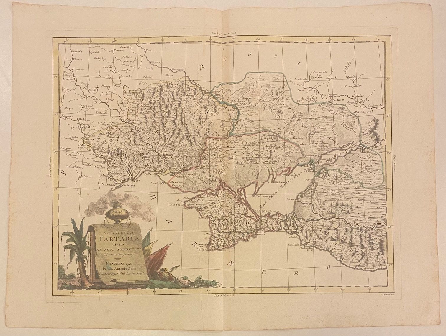
La Piccola Tartaria divisa Ne'suoi Territori di nuova Projezione
- unbound
- Venice: Antonio Zatta, 1783
Venice: Antonio Zatta, 1783. unbound. Map. Engraving with original hand outline. Image measures 12 1/4" x 16"
Nicely detailed map of the region comprising modern Ukraine and part of Russia. Centered on the Crimean Peninsula, the map extends from the Dnister River to the Caucasus Mountains. Hand-colored outline delineates regional divisions, reflecting ongoing military conflict between the Ottoman and Russian Empires. In good condition, with three small notations in manuscript noting the cities of Odessa, Vozia (incorrectly labeled), and Nikolajaw.
Antonio Zatta (1775-1797) was the most prominent Italian map publisher of the late 18th century. His Venice-based publishing company produced maps that mark an important transition from 18th- to 19th-century cartographic styles. He updates and redefines the traditional title cartouche by replacing the mythic elements common in earlier maps with more representative images.