Coast of Tanasserim
- unbound
- London: Laurie & Whittle, 1761
London: Laurie & Whittle, 1761. unbound. Sea chart. Uncolored copper plate engraving. Image measures 18 1/4 x 24 1/2 inches.
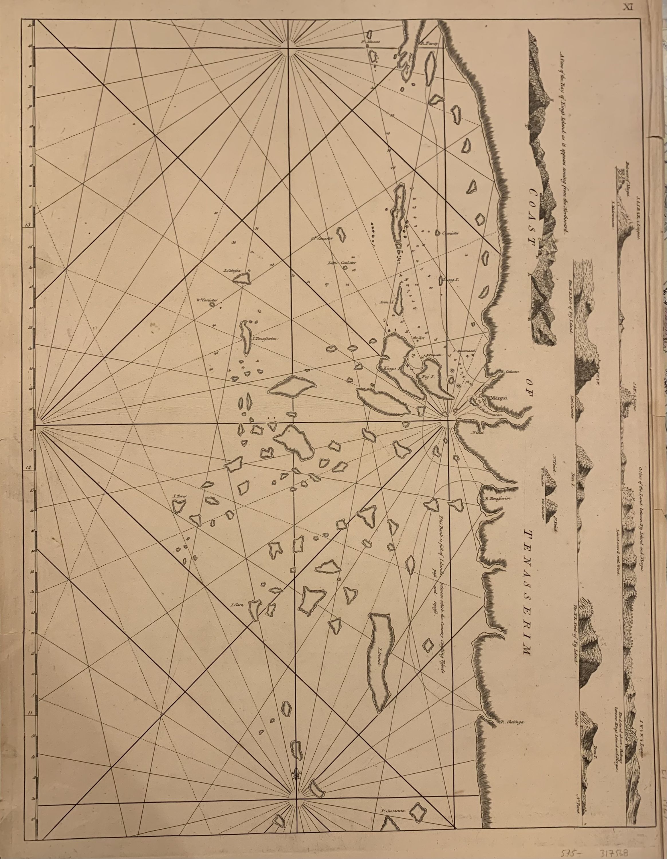
The Tenasserim Hills are part of a long granite mountain ridge that is older than the Himalayas. The Burmese range form a barrier between the Andaman sea and the Gulf of Thailand. Elevations shown in side profile, oriented to the left. Tiny islands and reefs described in detail but not named.Published in "The East-India Pilot, or Oriental Navigator, on One Hundred and Eighteen Plates: Containing a Complete Collection of Charts and Plans, &c...". Maps are based on the 1745 French "Neptune Oriental" by Jean Baptiste Nicolas Denis d'Apres de Mannevillette. The later English editions include additions by Captain Hayter, Captain John Ritchie and Captain Charles Newland. Chips to upper margin, otherwise in good condition.vRobert Laurie (c. 1755 - 1836) and James Whittle (1757-1818) were London-based map and atlas publishers active in the late 18th and early 19th century. Their firm combined Laurie's engraving skills with Whittle's social contacts and print sales experience. Together, they published numerous maps and atlases, often enlisting prominent cartographers such as Kitchin, Faden, Jefferys and others to update and modify their plates.
The Tenasserim Hills are part of a long granite mountain ridge that is older than the Himalayas. The Burmese range form a barrier between the Andaman sea and the Gulf of Thailand. Elevations shown in side profile, oriented to the left. Tiny islands and reefs described in detail but not named.Published in "The East-India Pilot, or Oriental Navigator, on One Hundred and Eighteen Plates: Containing a Complete Collection of Charts and Plans, &c...". Maps are based on the 1745 French "Neptune Oriental" by Jean Baptiste Nicolas Denis d'Apres de Mannevillette. The later English editions include additions by Captain Hayter, Captain John Ritchie and Captain Charles Newland. Chips to upper margin, otherwise in good condition.vRobert Laurie (c. 1755 - 1836) and James Whittle (1757-1818) were London-based map and atlas publishers active in the late 18th and early 19th century. Their firm combined Laurie's engraving skills with Whittle's social contacts and print sales experience. Together, they published numerous maps and atlases, often enlisting prominent cartographers such as Kitchin, Faden, Jefferys and others to update and modify their plates.