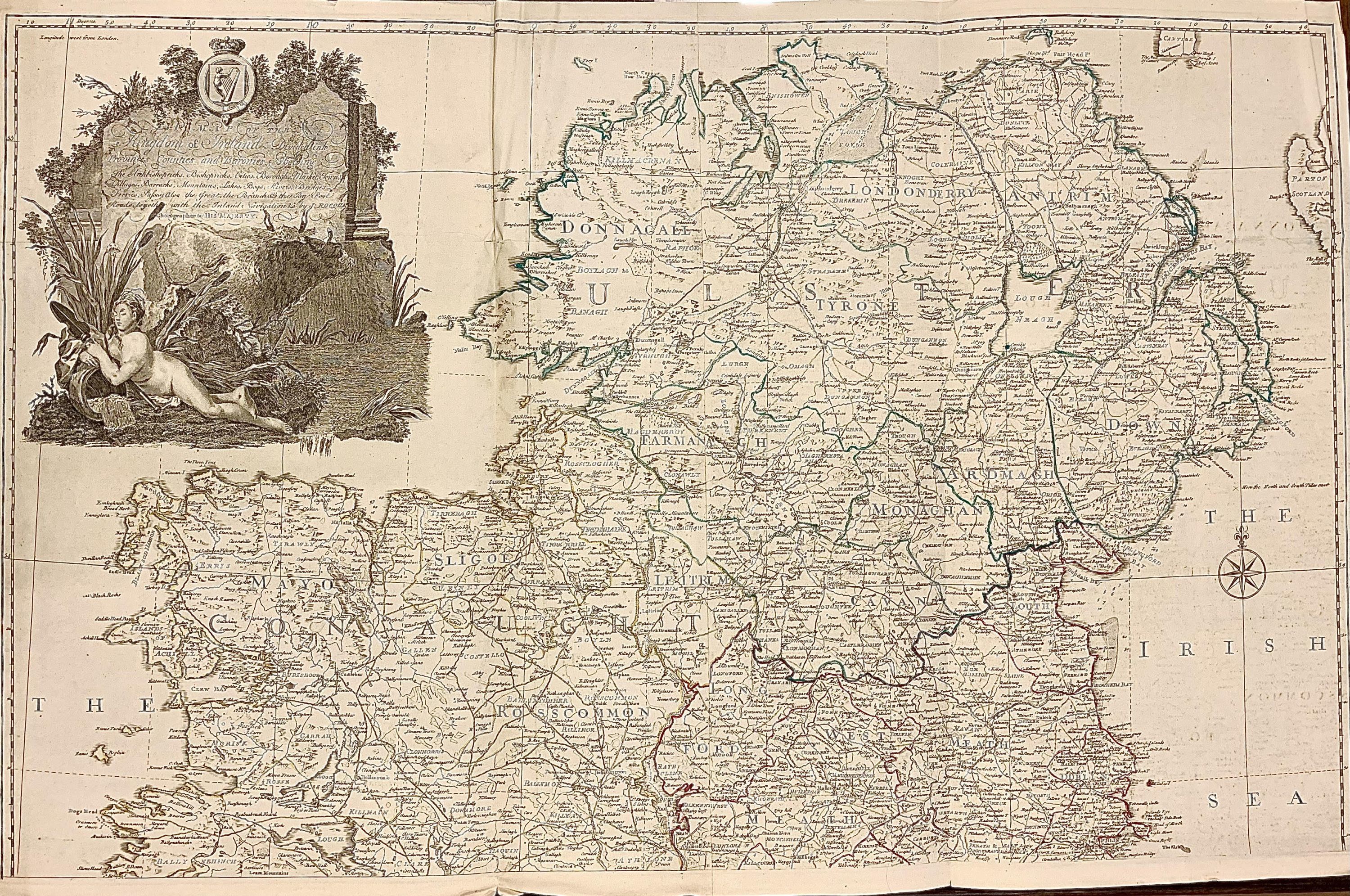
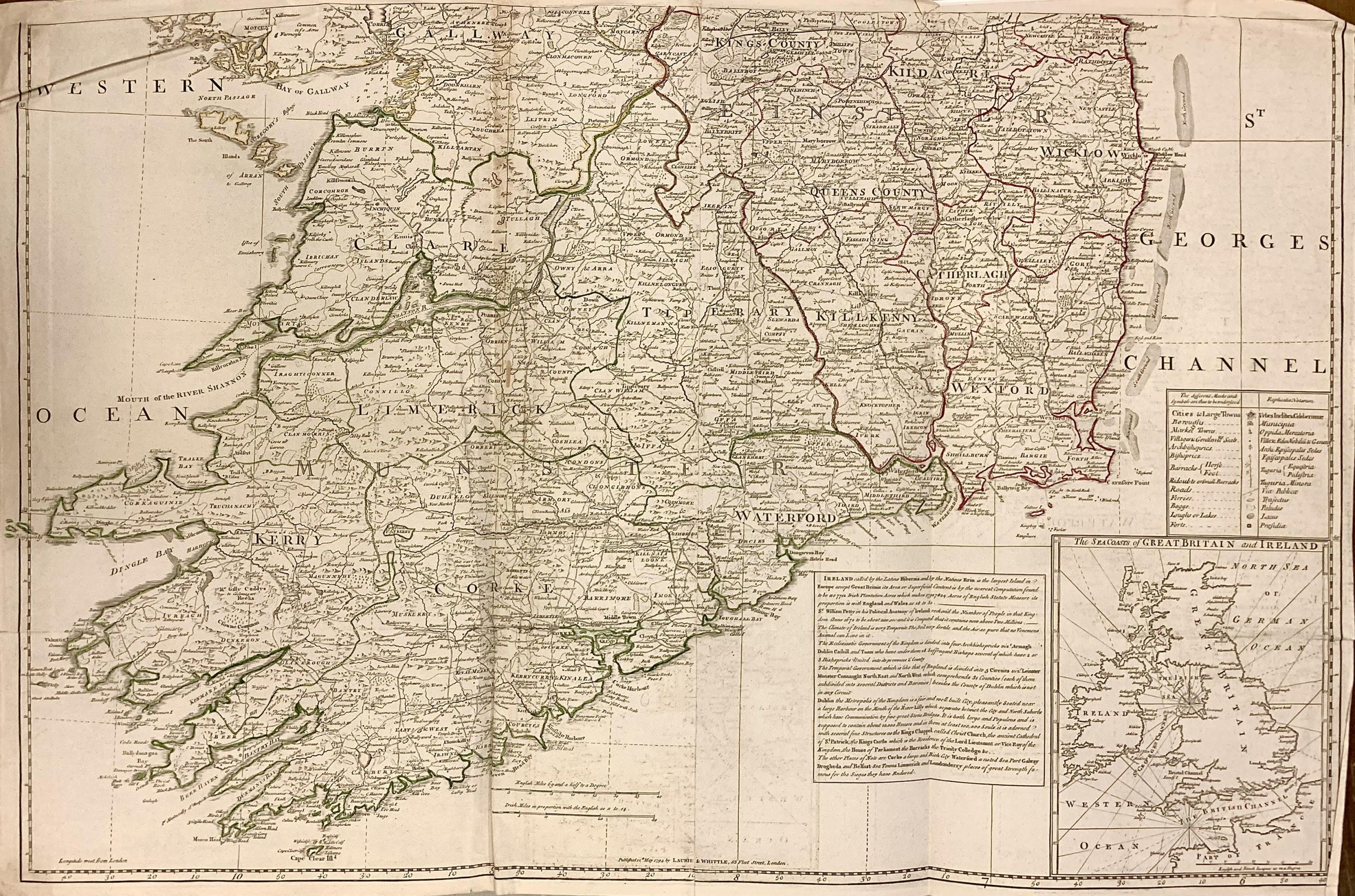
A Map of the Kingdom of Ireland, Divided into Provinces Counties and Baronies, showing the Archbishopricks, Bishopricks, Cities, Boroughs, Market Towns, Villages, Barracks, Mountains, Lakes, Bogs, Rivers, Bridges Ferries, Passes, also the Great, the Branch, & the By Post Roads, together with the Inland Navigation &c
- unbound
- London: Laurie & Whittle, 1794
London: Laurie & Whittle, 1794. unbound. Map (in two panels). Engraving with original hand outline. Map in top panel measures 23.5" x 38.25, and panel measures 25.25" x 39". Map in bottom panel measures 24.75" x 38.5", and panel measures 26.5" x 39".
This is an impressive 2 panel wall map of Ireland published in 1794 by Laurie and Whittle. Created by John Rocque, this is one of the largest maps of Ireland produced during the time. Beautifully detailed, the map notes cities, market towns, villages, mountains, lakes, bogs, bridges, shoals, lochs, ferries and numerous other topographical detail. Divided into 2 panes, the top panel covers the northern portions of Ireland while the bottom panel depicts the southern part of Ireland. An elaborate title cartouche in the top left features the Irish harp, a maiden and cattle. A detailed description appears in the lower right. Lower right also includes a detailed key and an inset of The Sea Coasts of Great Britain and Ireland. Hand-colored lines divide and subdivide counties and shire. The map is in good condition with minor wear along the original folds, some creasing, and minimal toning. Minor verso repairs along some folds.
Robert Laurie (c. 1755 - 1836) and James Whittle (1757-1818) were London-based map and atlas publishers active in the late 18th and early 19th century. They formed their firm following the death of their employer Robert Sayer, who was an important English publisher of maps, portraits, and nautical engravings. Their firm combined Laurie's engraving skills with Whittle's social contacts and print sales experience. Together, they published numerous maps and atlases, often enlisting prominent cartographers such as Kitchin, Faden, Jefferys and others to update and modify their plates.
John Rocque (1704-1762) was a Swiss Huguenot who grew up in London. He started his career as landscape designer, and eventually worked as a land surveyor, publisher and engraver. He was known for his elaborate maps of London and its surroundings. He made significant contributions working with Irish maps and various England county maps. After his death, his widow, Mary Anne, continued to manage the business for several years. This fine map demonstrates his attention to detail.