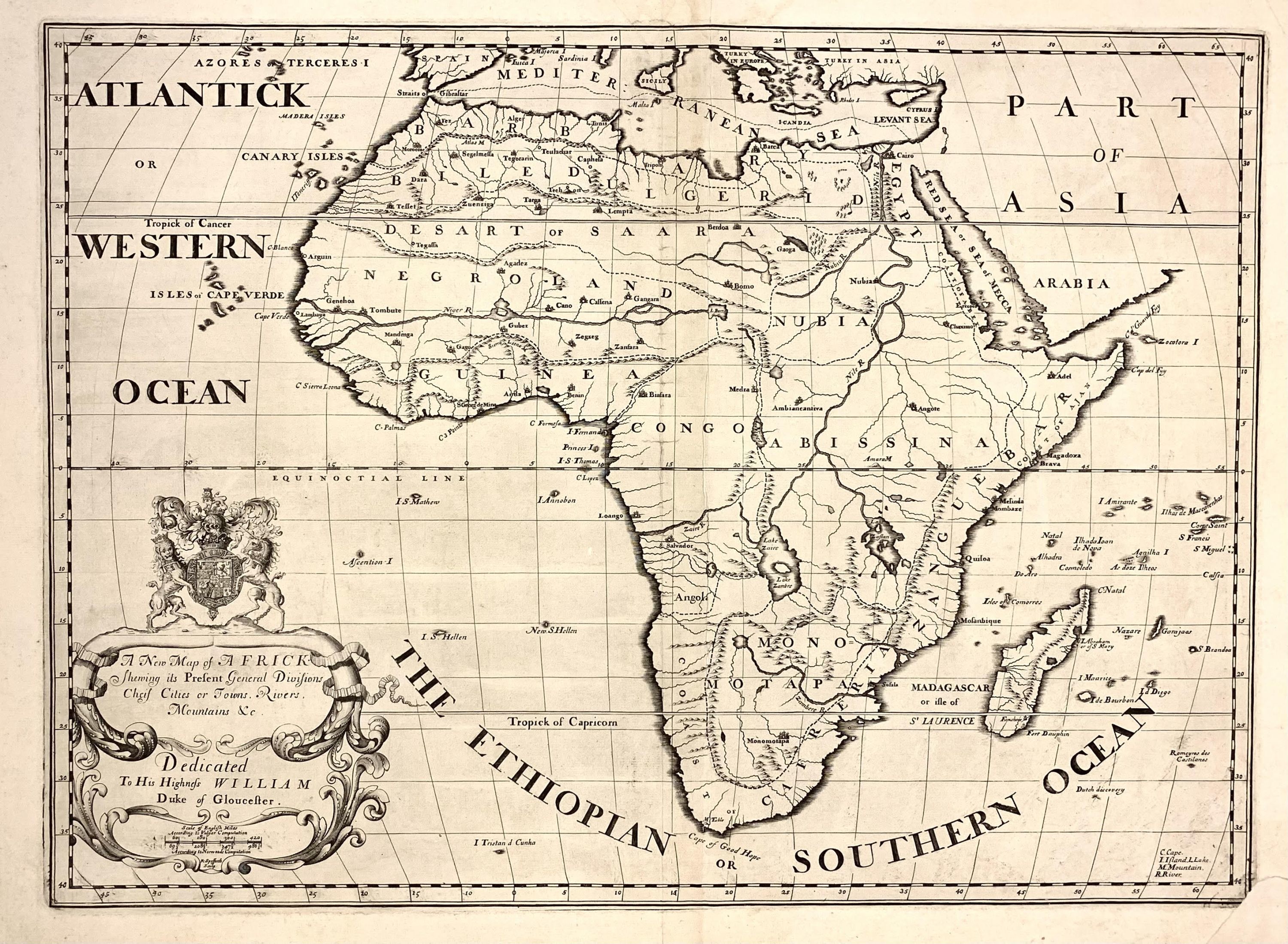
A New Map of Africk Shewing Its Present General Divisions, Chief Cities or Towns, Rivers, Mountains &c
- unbound
- Oxford: Edward Wells, 1712
Oxford: Edward Wells, 1712. unbound. Map. Uncolored copper plate engraving. Image measures 14.5" x 20".
Simplified 1712 map of Africa created by Edward Wells, showcasing the entire continent, including Madagascar, from an 18th-century perspective. The map highlights the well-mapped coastlines contrasted with the speculative interiors with the Sea of Mecca noted in the red sea.
Despite the lack of true knowledge, cartographers like Wells included speculative features in early maps. This example is no exception. The sources of the White Nile are based on the Ptolemaic model, with two large lakes, Zaire and Zaflan noted near the mythical 'Mountains of the Moon,' which remain unidentified here. In later maps of the 19th century, these lakes would eventually be merged into the real Lakes Malawi and Victoria. In southern Africa, the map features the Empires of Monoemugi and Monomotapa, noted for their gold mining regions.
The map includes a decorative cartouche with the Duke of Gloucester's coat of arms, reflecting Wells' dedication to Prince William, Duke of Gloucester, who was a young Oxford student at the time. This map was part of Wells' atlas, "A New Sett of Maps both of Ancient and Present Geography," known for its geographical accuracy and strong engraved images. This edition, published by T. Bonwicke in 1712, provides a glimpse into the geo-political borders and speculative geography of Africa at the end of the 17th century. In good condition with minor toning and foxing. Lower left corner shows repaired.
Edward Wells (1667-1727) was an English mathematician, geographer, and classical scholar affiliated with Christ Church College, Oxford. Originally training for the ministry, Wells found his calling in academia, where he authored numerous works on mathematical and scientific topics. He tutored Prince William, son of Queen Anne, to whom he dedicated many of his maps, likely posthumously, as the prince died in 1700 before the publication of Wells' atlas. Wells' atlas, "A New Sett of Maps both of Ancient and Present Geography," was popular and went through several editions into the 1730s. Instead of focusing on grand decoration, perhaps Wells used a simpler approach for educational purposes. His maps were valued for their accuracy and aesthetic appeal. This is a beautiful example of his work.