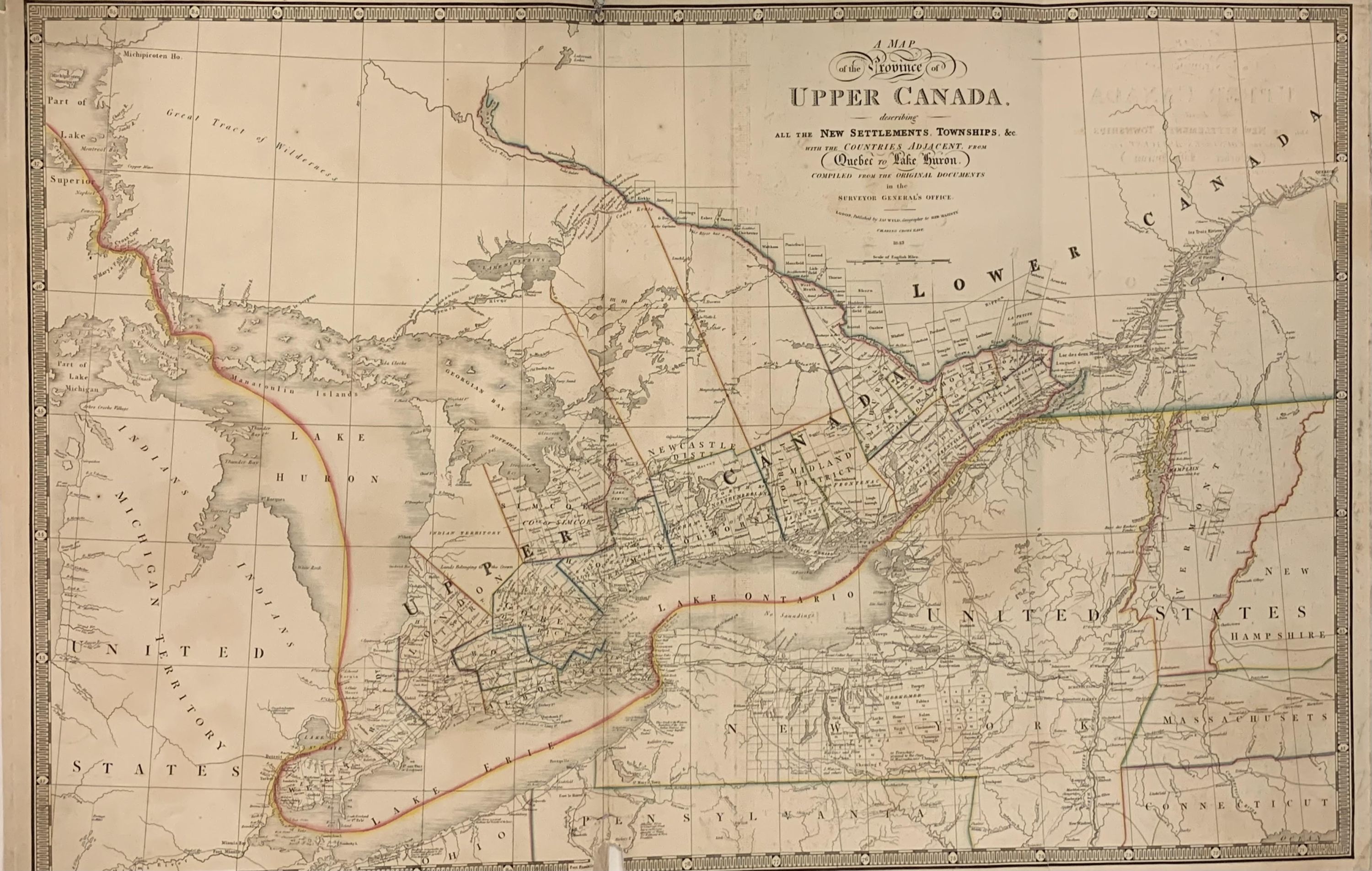
A Map of the Province of Upper Canada, describing all the New Settlements, Townships, &c. with the Countries Adjacent, From Quebec to Lake Huron.; Compiled from the Original Documents in Surveyor General's Office
- unbound
- London: James Wyld, 1843
London: James Wyld, 1843. unbound. Map. Hand colored engraving. 23 1/4" x 35 3/4"
Incredibly detailed 1843 Railroad map of Ontario, Canada, also known as Upper Canada, divided into districts and counties. First published by David William Smyth, major roads, rivers, towns, cities, lakes, rivers, and other landmarks are noted. Shows from Michigan and Lake Huron over to Vermont and New Hampshire, and part of New York State, extending up to the southern border of Lower Canada. Unique hand coloring used on the borders. Indian territory noted and reservations for 6 nations in Gore district included. Upper Canada. Some damage to creases, but otherwise in good condition. James Wyld Senior (1790-1836) was a distinguished British mapmaker known for producing maps and globes. He served as Geographer to George IV and William IV. This lovely map of is a fine example of his work. Tooley, The Mapping of America, 82(f).
Incredibly detailed 1843 Railroad map of Ontario, Canada, also known as Upper Canada, divided into districts and counties. First published by David William Smyth, major roads, rivers, towns, cities, lakes, rivers, and other landmarks are noted. Shows from Michigan and Lake Huron over to Vermont and New Hampshire, and part of New York State, extending up to the southern border of Lower Canada. Unique hand coloring used on the borders. Indian territory noted and reservations for 6 nations in Gore district included. Upper Canada. Some damage to creases, but otherwise in good condition. James Wyld Senior (1790-1836) was a distinguished British mapmaker known for producing maps and globes. He served as Geographer to George IV and William IV. This lovely map of is a fine example of his work. Tooley, The Mapping of America, 82(f).