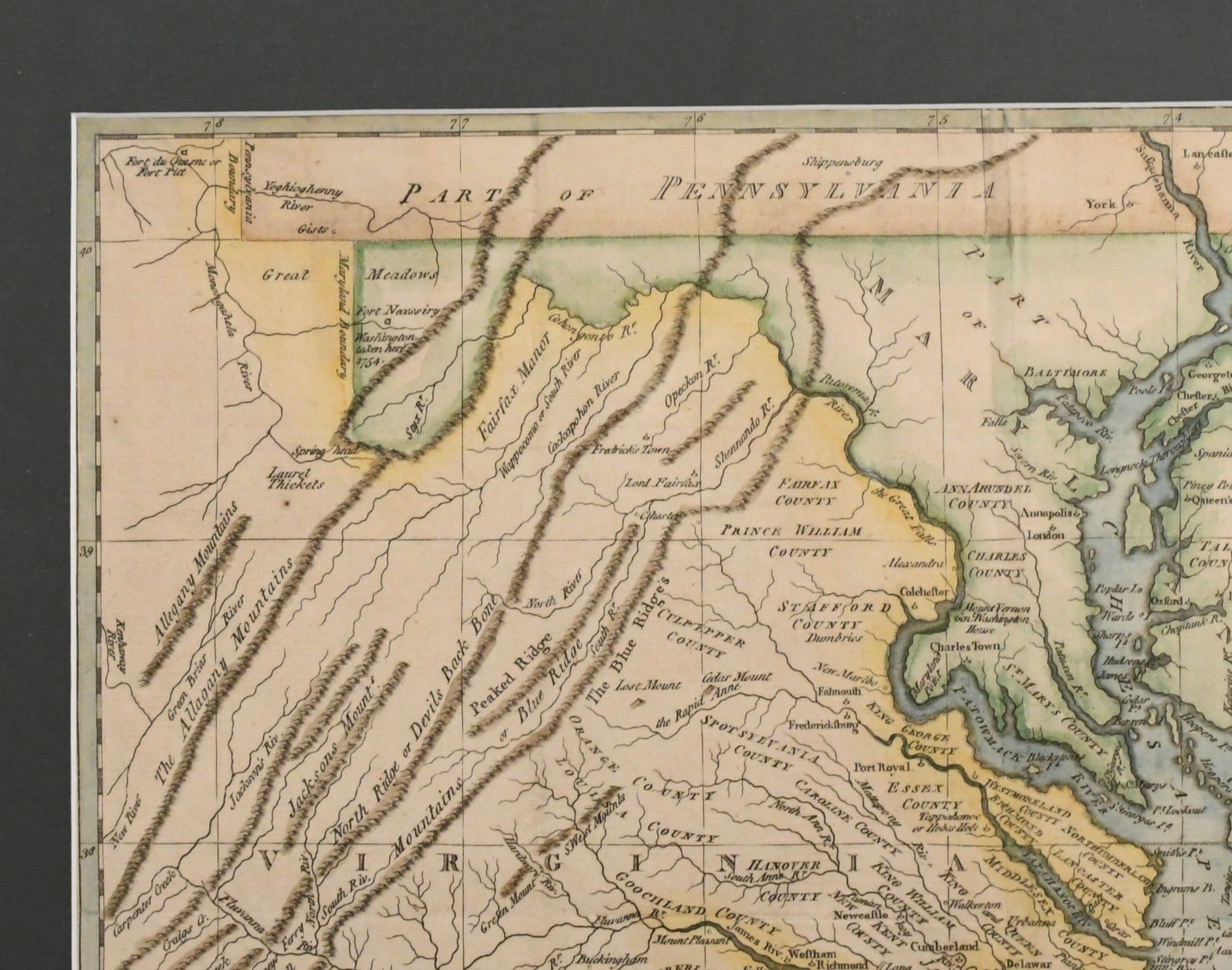
[MAPS] [REVOLUTION] A NEW AND ACCURATE MAP OF VA..
![[MAPS] [REVOLUTION] A NEW AND ACCURATE MAP OF VA..](https://d3525k1ryd2155.cloudfront.net/h/218/543/1651543218.0.x.jpg)
- London: J. Bew, 1780
London: J. Bew, 1780. A New and accurate map of Virginia, and part of Maryland and Pennsylvania. Published in London by J. Bew, 1780.~~Revolutionary War era map extending to the Allegany in the West. Shows topographical details and the location near Fort Necessity where George Washington was captured by the British in 1754.~Hand colored. Excellent.~~Framed: 16 1/4” x 21 1/4”~Image: 10 1/2” x 14 1/2”.