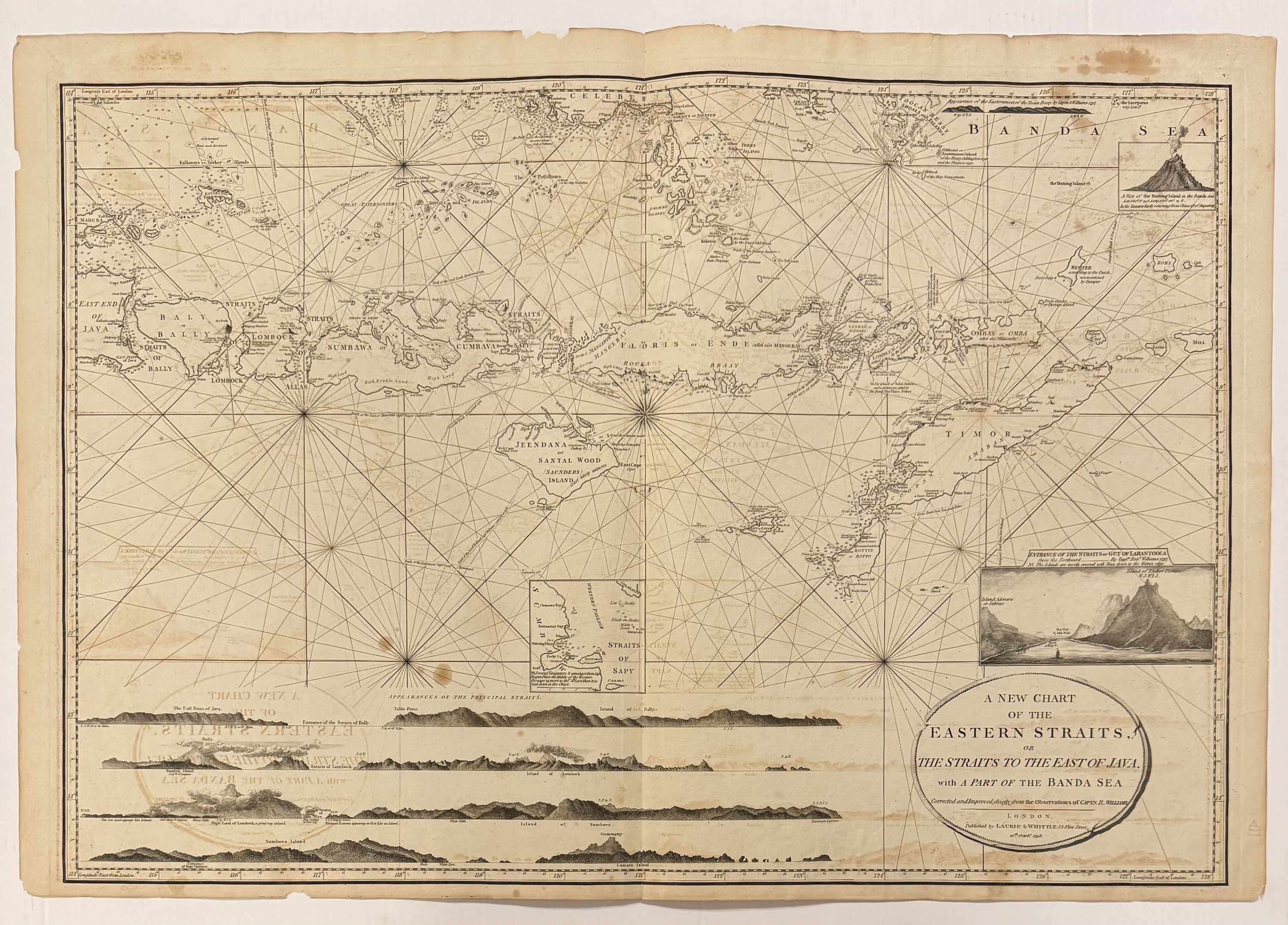
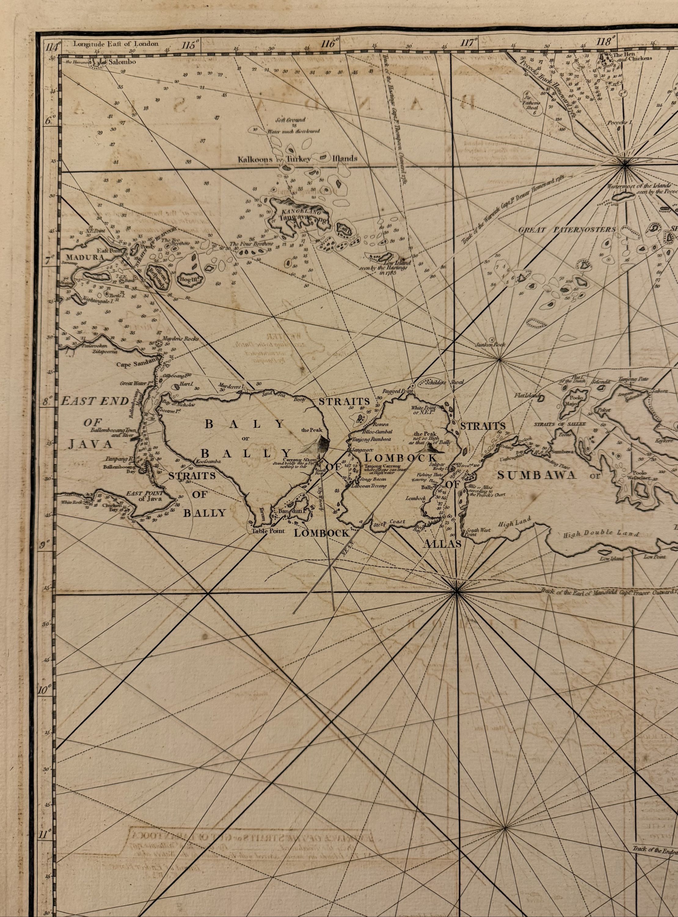
A New Chart of the Eastern Straits or The Straits to the East of Java with a Part of the Banda Sea
- unbound
- London: Laurie & Whittle, 1798
London: Laurie & Whittle, 1798. unbound. Robert Williams. Sea chart. Sheet measures 25 1/4" x 36 3/4".
Wonderfully intricate sea chart of the southern East Indies, including Bali, East Timor, and parts of Java and the Banda Sea. Inset illustrations of a smoldering volcano, the Straits of Lantooca, and elevations of each island's coastlines. Robert Laurie (c. 1755 - 1836) and James Whittle (1757-1818) were London-based map and atlas publishers active in the late 18th and early 19th century. Their firm combined Laurie's engraving skills with Whittle's social contacts and print sales experience. Together, they published numerous maps and atlases, often enlisting prominent cartographers such as Kitchin, Faden, Jefferys and others to update and modify their plates. This map is a beautiful example of their work.
Wonderfully intricate sea chart of the southern East Indies, including Bali, East Timor, and parts of Java and the Banda Sea. Inset illustrations of a smoldering volcano, the Straits of Lantooca, and elevations of each island's coastlines. Robert Laurie (c. 1755 - 1836) and James Whittle (1757-1818) were London-based map and atlas publishers active in the late 18th and early 19th century. Their firm combined Laurie's engraving skills with Whittle's social contacts and print sales experience. Together, they published numerous maps and atlases, often enlisting prominent cartographers such as Kitchin, Faden, Jefferys and others to update and modify their plates. This map is a beautiful example of their work.