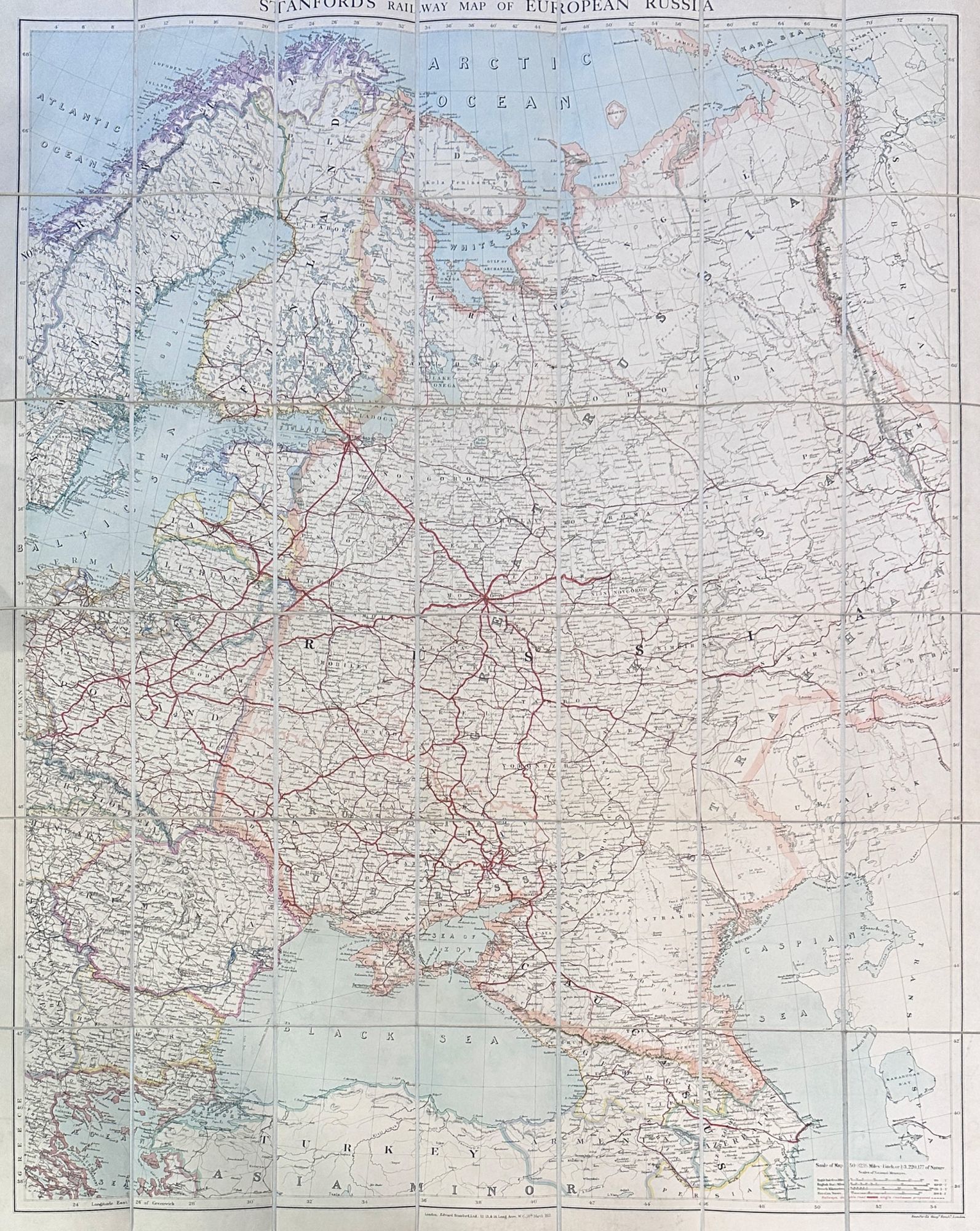
Stanford's Railway Map of European Russia

- London: Edward Stanford, Ltd, 1922
London: Edward Stanford, Ltd, 1922. Large folding map. Lithograph in colors on uncoated paper, dissected and laid down on linen (as issued); overall dimensions 123cm x 97cm (ca 48" x 38"), folding to 20cm x 14cm (8" x 5-1/2"); card covers with publisher's slipcase of maroon cloth with printed paper title label. A bright, clean, well-preserved example, Very Good to Near Fine. In the original slipcase, cloth lightly rubbed at corners and a bit of soil to title label, still easily Very Good.
An impressive Revolutionary-era map of Russia, in 42 sections, scaled 1 inch to 50 miles. This revision, dated March, 1922, would appear to be the fourth and final edition of the map – it was preceded by editions in 1915, 1917, and 1919. By December, 1922, the Soviet Union would be formally established, with Azerbaijan, Georgia, Belarus and Armenia (which all appear here as independent states) being absorbed into the Union of Soviet Socialist Republics.
An impressive Revolutionary-era map of Russia, in 42 sections, scaled 1 inch to 50 miles. This revision, dated March, 1922, would appear to be the fourth and final edition of the map – it was preceded by editions in 1915, 1917, and 1919. By December, 1922, the Soviet Union would be formally established, with Azerbaijan, Georgia, Belarus and Armenia (which all appear here as independent states) being absorbed into the Union of Soviet Socialist Republics.