Maps and Charts Prepared by the Slum Clearance Committee of New York 1933-34

- SIGNED Bevelled boards
- The Slum Clearance Committee of New York, 1934
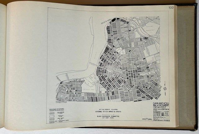
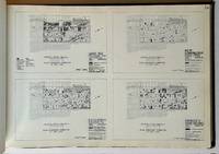
The Slum Clearance Committee of New York, 1934. Bevelled boards. Very Good +. Seminal 1934 study by New York's "Slum Clearance Committee", using detailed charts and maps to document "health and economic data" in New York City neighborhoods (of Manhattan and Brooklyn only) in the 1930s. Employing well over 100 maps and drawings to document (along each recto) health and economic conditions, showcasing specific information on seemingly every urban reality of the day, from "fatal fires 1929-1933" to "vehicular accident deaths (over 16 years -- 1933"), from "crime (addresses of offenders) in 1930" to "venereal disease case rate 1930-32", from "tenement house violations" to "gain and loss real estate assessment 1904-1933". A dizzying array of the menacing issues which plagued New York's Depression-era "slums". A very presentable copy to boot of the uncommon 1934 1st edition. Solid and VG to VG+ in its bevelled dark boards, with bright gilt-titling along the spine. A bit of minor loss at the spine crown, very light wear along the tips, light soiling to the title page. All plates crisp and bright and presenting very well. (A partial description from the copy residing at the Olin Library at Cornell: "In 1933 a citizen's committee was organized in New York with the purpose of promoting the creation of a municipal housing authority empowered to use federal funds for low-cost housing and 'slum clearance'". Not surprisingly, it adopted the name The Slum Clearance Committee of New York. The committee's main task was securing legislation permitting the creation of the municipal housing authority. And this necessitated the prerparation of informative data through new studies and use of existing material in order to locate sub-standard areas in the city as well as areas suitable for development of low-cost housing. In addition to the maps and charts prepared by the Slum Clearance Committee, the book presents maps and charts of the Land Utilization Committee of the New York Building Congress. The latter are noted on the individual drawings inside. An index map depicts 14 areas that were analyzed for clearance. A selection of maps illustrated data collection and analysis techniques used to determine suitability for clearance. These maps provide a window into some of the underlying asumptions of slum clearance").