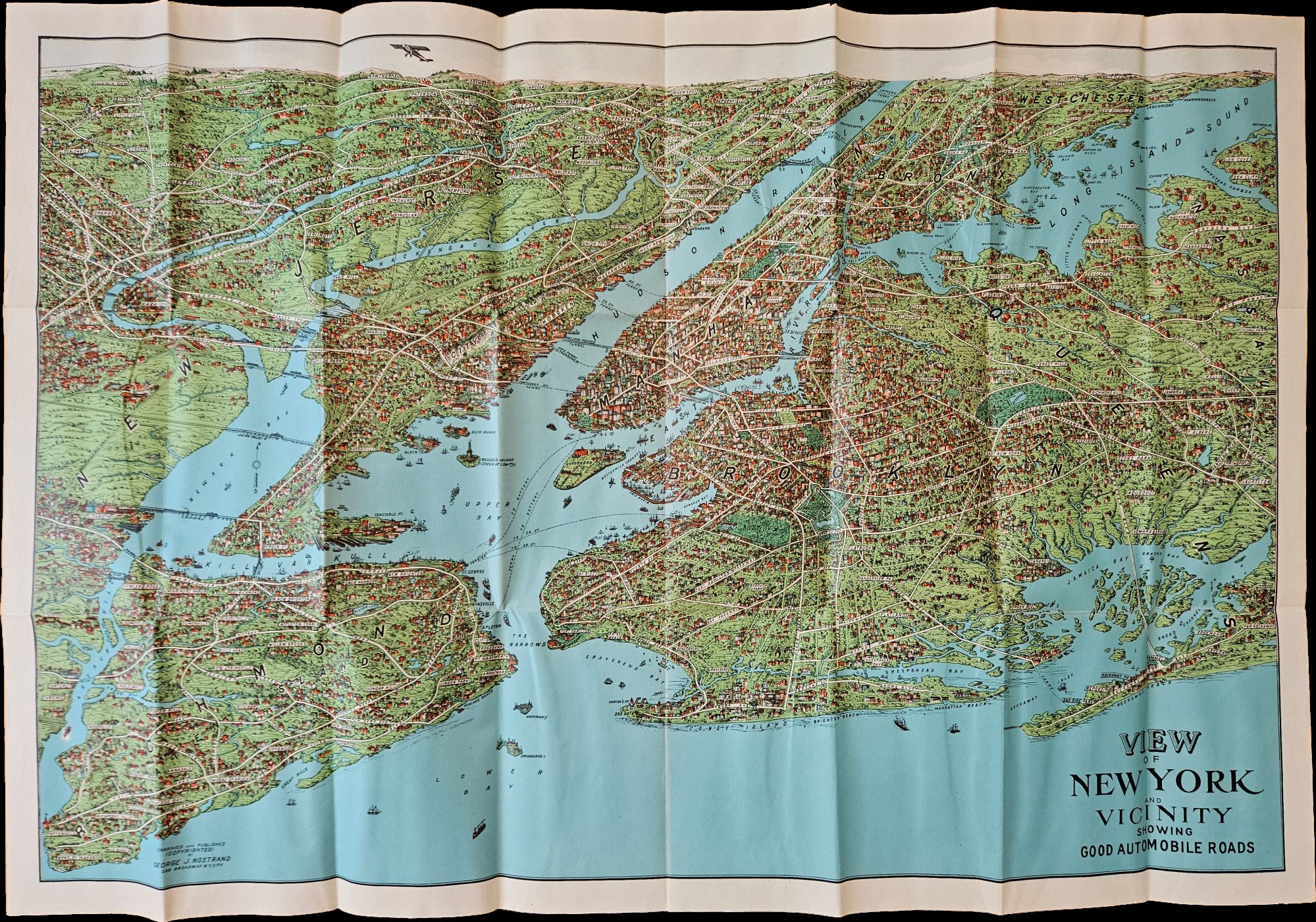
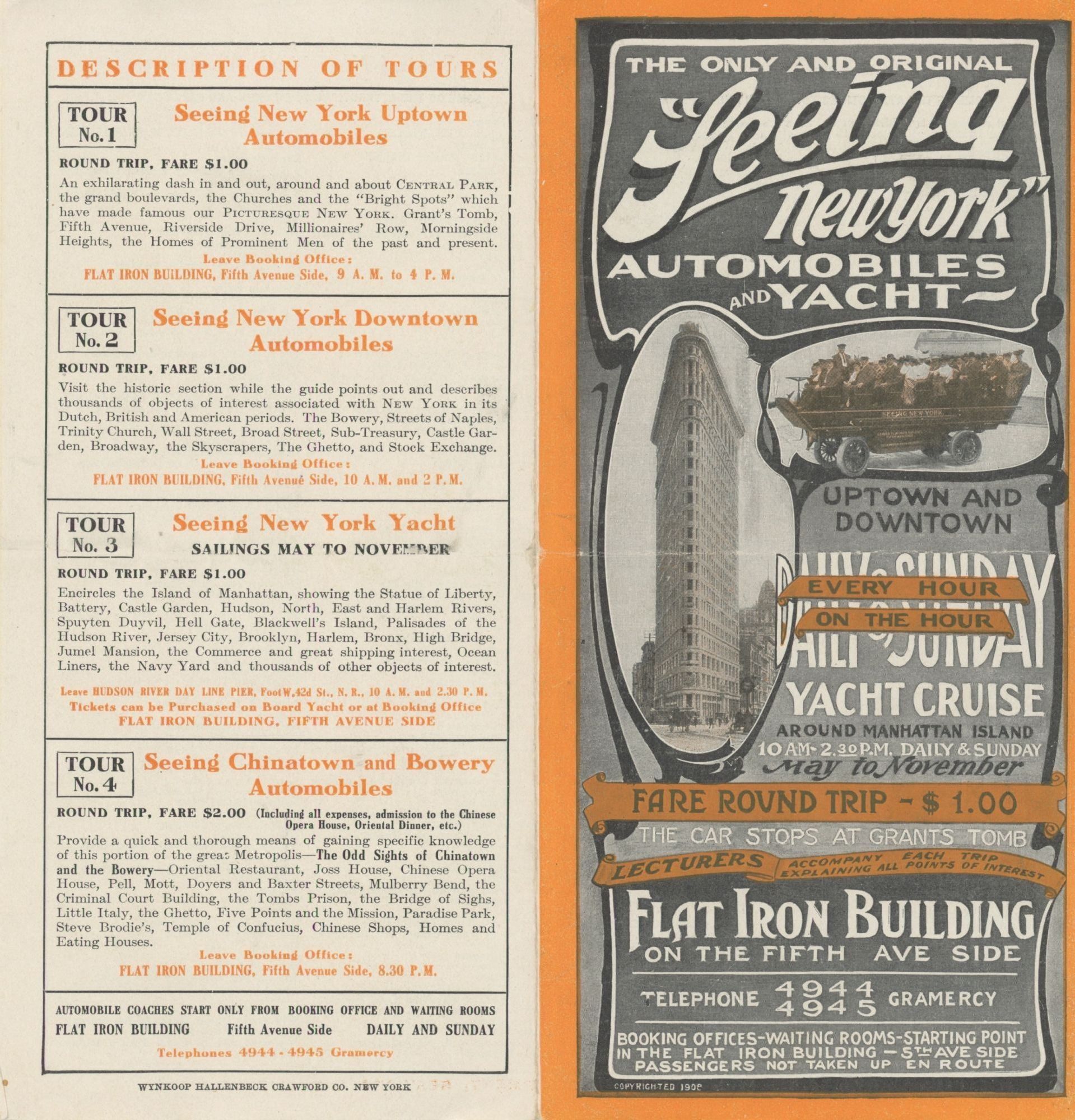
“View of New York and Vicinity Showing Good Automobile Roads” with “The Only and Original ‘Seeing New York’ Automobiles and Yacht” Pamphlet
- Map measuring 20 x 29 inches; trifold measuring 8 ½ x 12 inches. Map folded with some small tears at folds, slightly wrinkled,
- George J. Nostrand; Winkoop Hallenbeck Crawford Co, 1928
George J. Nostrand; Winkoop Hallenbeck Crawford Co, 1928. Map measuring 20 x 29 inches; trifold measuring 8 ½ x 12 inches. Map folded with some small tears at folds, slightly wrinkled, pencil markings verso; very attractive. Overall excellent.. Offered here is a large, attractive bird’s-eye view map of New York City and the surrounding areas by George J. Nostrand, a New York City-based lithographer and cartographer; and a small pamphlet advertising sightseeing tours by car or yacht (with “lecturers accompany[ing] each trip explaining all points of interest”). The map highlights the most car-friendly routes around the city and New Jersey as far west as Mountain View, and is beautifully illustrated with buildings, landmarks, and ships in the harbor. It was likely produced between 1927 and 1929 given certain details (for instance, the George Washington Bridge is labeled only as “proposed”); we find two copies of the 1928 printing and four of the 1929 printing on OCLC.