Baghdad City
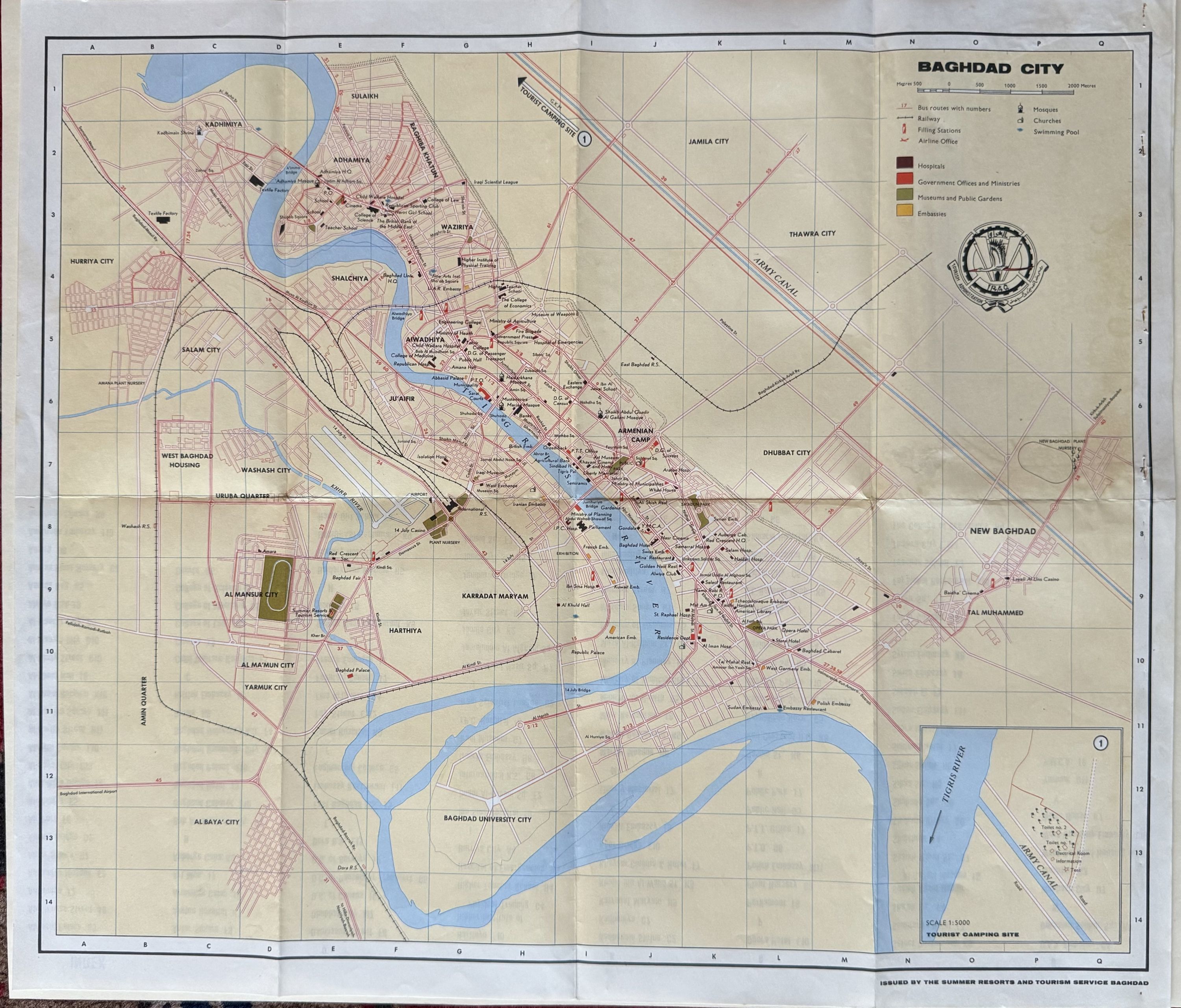
- Baghdad: Summer Resorts and Tourism Service
Baghdad: Summer Resorts and Tourism Service. Map. Lithograph. Measures 16 3/8" x 19 1/2"
This city plan of Baghdad was issued in the 1960s by the Summer Resorts and Tourism Service of Baghdad. With the Tigris River transecting the map, and grid lines outlining separate neighborhoods, the map shows bus routes, railways, filing stations, airlines offices, mosques & churches, hospitals, embassies, and swimming pools. Museums and public gardens are colored in green, and government offices and ministries in red. Many points of interests are labeled, with an additional index listing important sites on verso. An inset in the lower left corner depicts the Tourist Camping Site. In very good condition. Mounted on card stock in the upper right octant.
This city plan of Baghdad was issued in the 1960s by the Summer Resorts and Tourism Service of Baghdad. With the Tigris River transecting the map, and grid lines outlining separate neighborhoods, the map shows bus routes, railways, filing stations, airlines offices, mosques & churches, hospitals, embassies, and swimming pools. Museums and public gardens are colored in green, and government offices and ministries in red. Many points of interests are labeled, with an additional index listing important sites on verso. An inset in the lower left corner depicts the Tourist Camping Site. In very good condition. Mounted on card stock in the upper right octant.