A New Map of Greece

- unbound
- London: James Wyld, 1840
London: James Wyld, 1840. unbound. Map. Engraving with original color outline. Image measures 28 3/8" x 19 7/8"
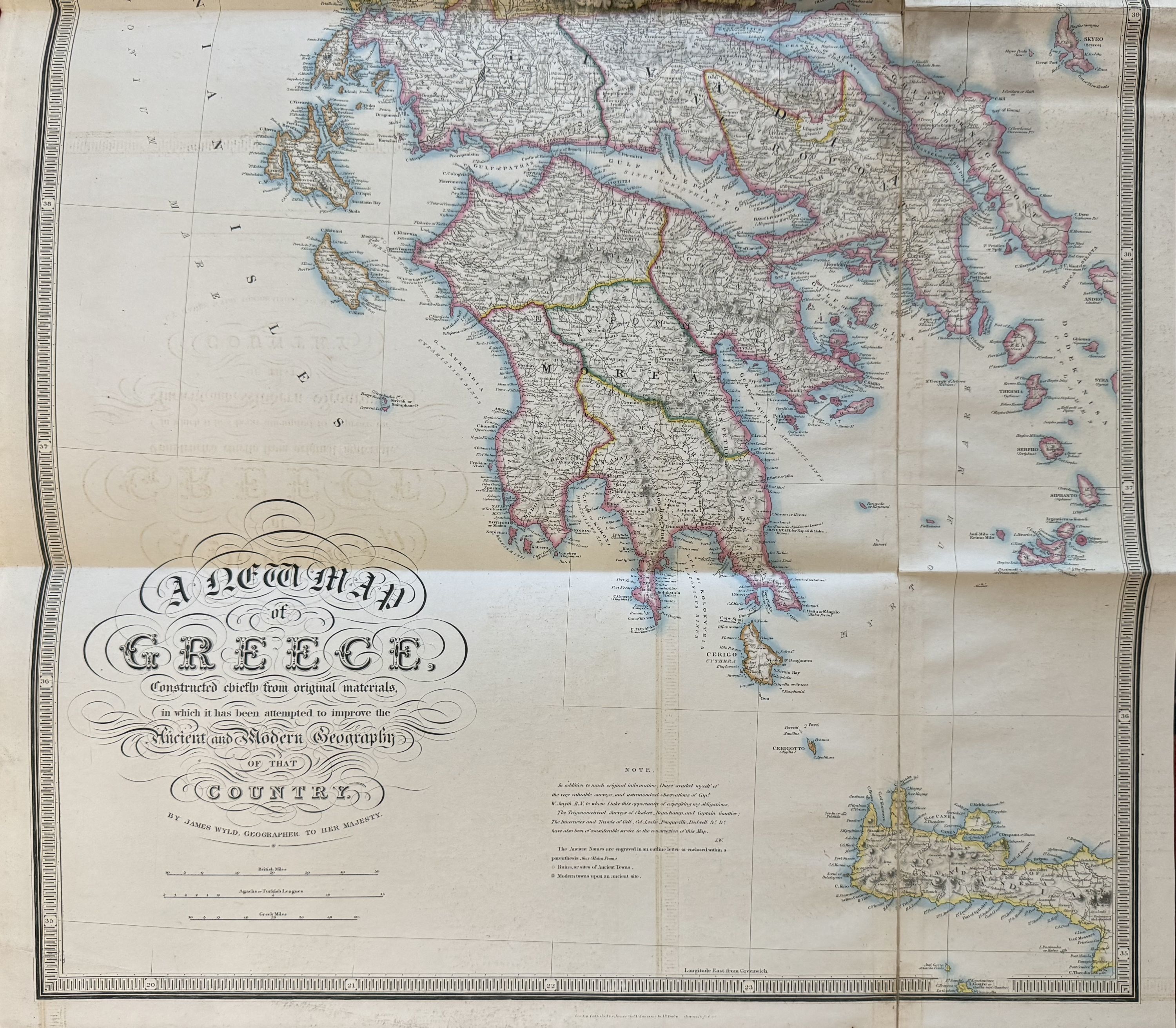
This oversized map of Greece published in 1845 displays an impressive compilation of cartographic information from various sources listed. Wyld notes "In addition to much original information, I have availed myself of the very valuable surveys and astronomical observations of Captain W. Smyth, R.N. to whom I take this opportunity of expressing my obligations. The trigonometrical surveys of Chabert, Beauchamp, and Captain Gauttier [Galthier de Rigny]; the itineraries and travels of [Sir William] Gell, Col. Leake, Pouqueville, Dodwell &c. have also been of consideration service in the construction of this map." Extensively detailed, the map shows cities, towns, rivers, roadways, islands, mountains, and ports. Topography is depicted by hachure. In very good condition, with minor offsetting and original fold lines as issued. Vertical fold line along the right side reinforced with original linen, with some minor splits at intersections of fold lines.
James Wyld Senior (1790-1836) was a distinguished British mapmaker known for producing maps and globes. He served as Geographer to George IV and William IV. He was a founding member of the Royal Geographical Society and introduced lithography techniques to his production. His son James Wyld Junior (1812-1887) was the official geographer to Queen Victoria. This lovely map of is a fine example of his work.