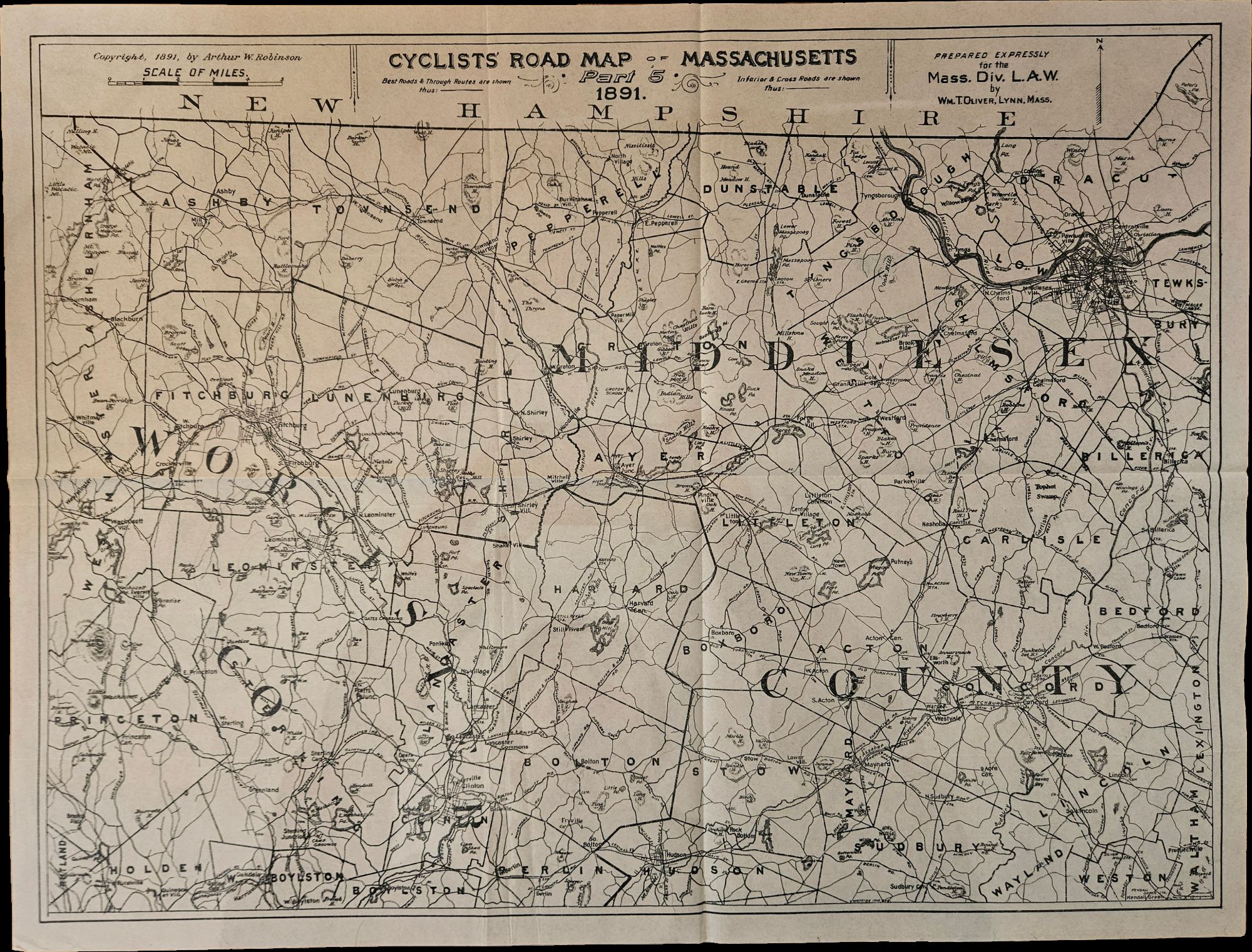
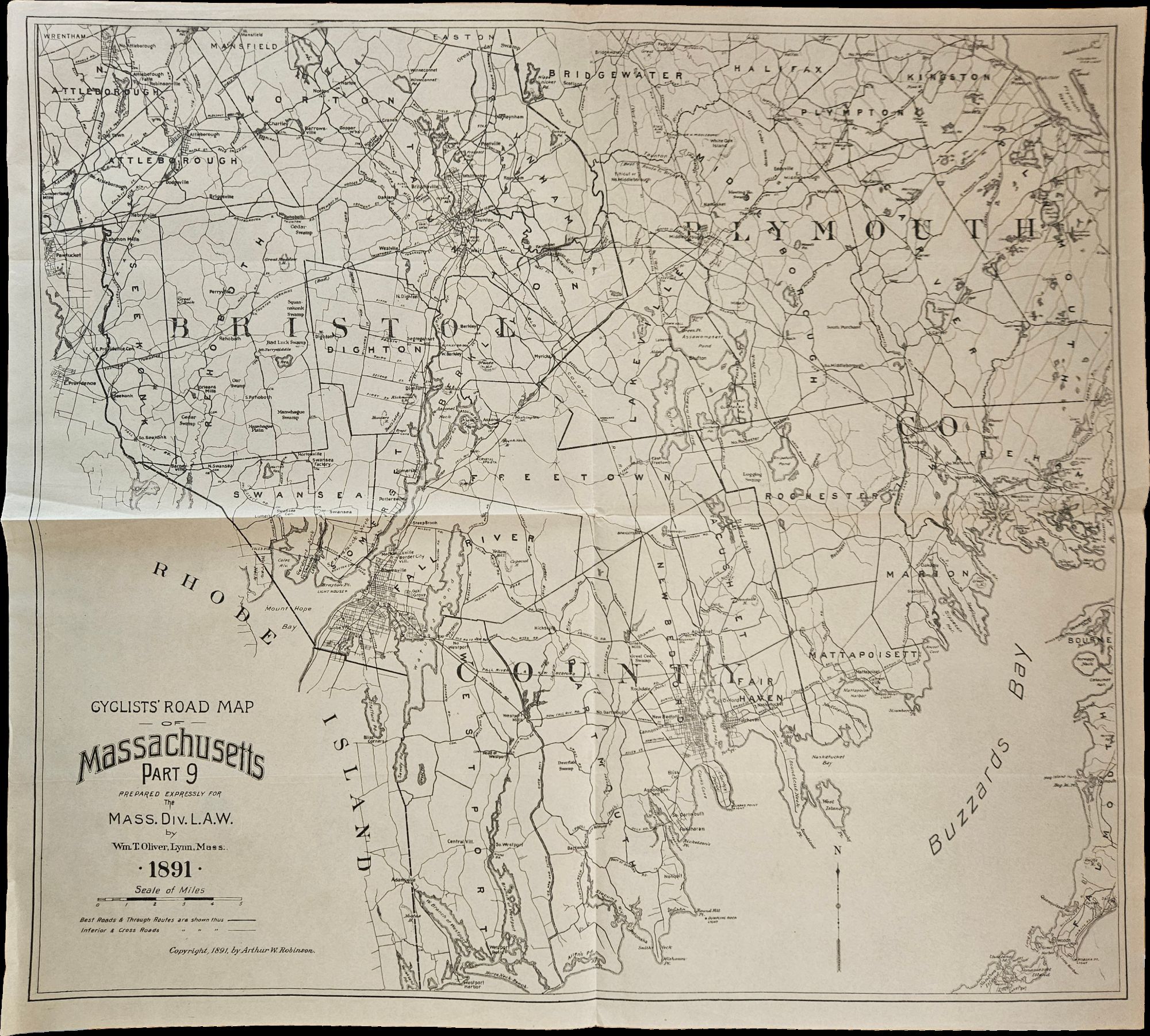
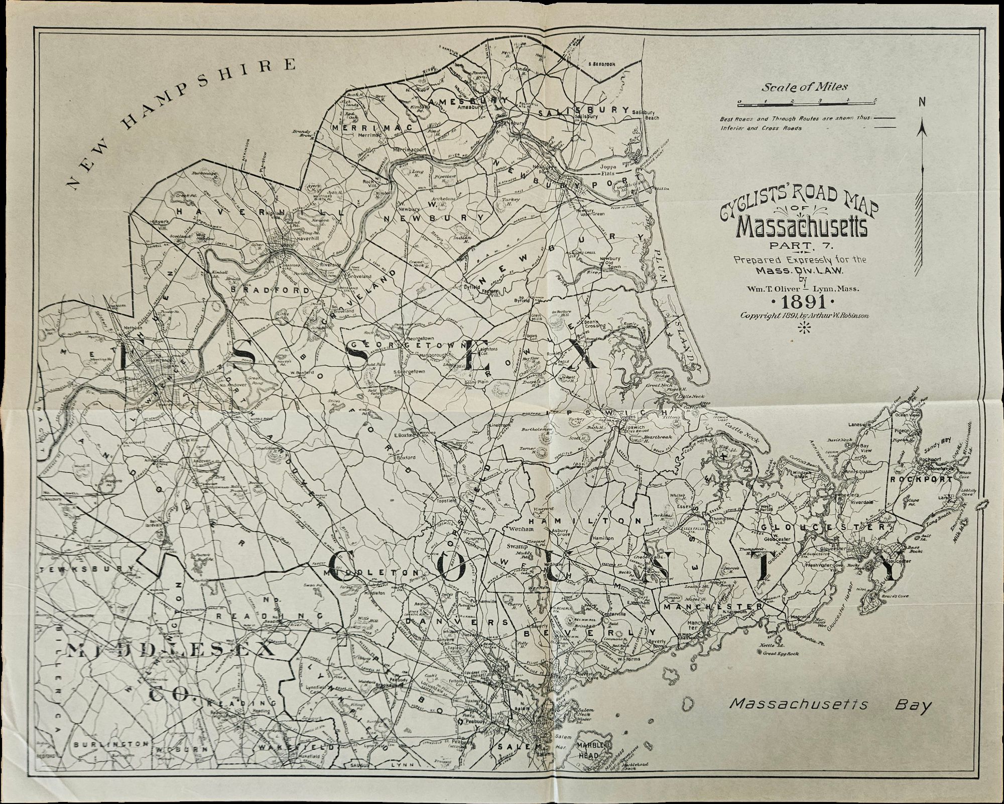
Nine Cyclists’ Road Maps of Massachusetts, Prepared for the Massachusetts Division of the League of American Wheelmen
- Nine of a ten-map series mostly measuring 14 ½ x 19 inches
- Lynn, Massachusetts: Arthur W. Robinson, 1891
Lynn, Massachusetts: Arthur W. Robinson, 1891. Nine of a ten-map series mostly measuring 14 ½ x 19 inches. Folded with slight marginal folding and wrinkling; Near Fine.. Nine of a set of ten maps of the entire state of Massachusetts, produced in 1891 for the League of American Wheelmen. The League was founded in Rhode Island in 1880 as a membership organization for cyclists. Besides presiding over racing and producing cycling guidebooks, it advocated for increased government spending on road improvements, especially for rural roads; these maps indicate roads of superior and inferior quality. In the 1890s there was a boom in cycling’s popularity, mainly because of several inventions that allowed a safer and more pleasant ride compared to that of a penny-farthing.
This group is near complete; we find two complete editions on OCLC.
This group is near complete; we find two complete editions on OCLC.