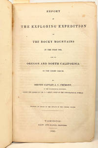
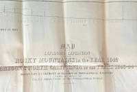
Report of the Exploring Expedition to the Rocky Mountains in the Year 1842, and to Oregon and North California in the Years 1843-'44; [28th Congress, 2nd Session Senate Executive Document No. 174, Serial 461]
- SIGNED Clamshell case
- Washington DC: Gales and Seaton, 1845
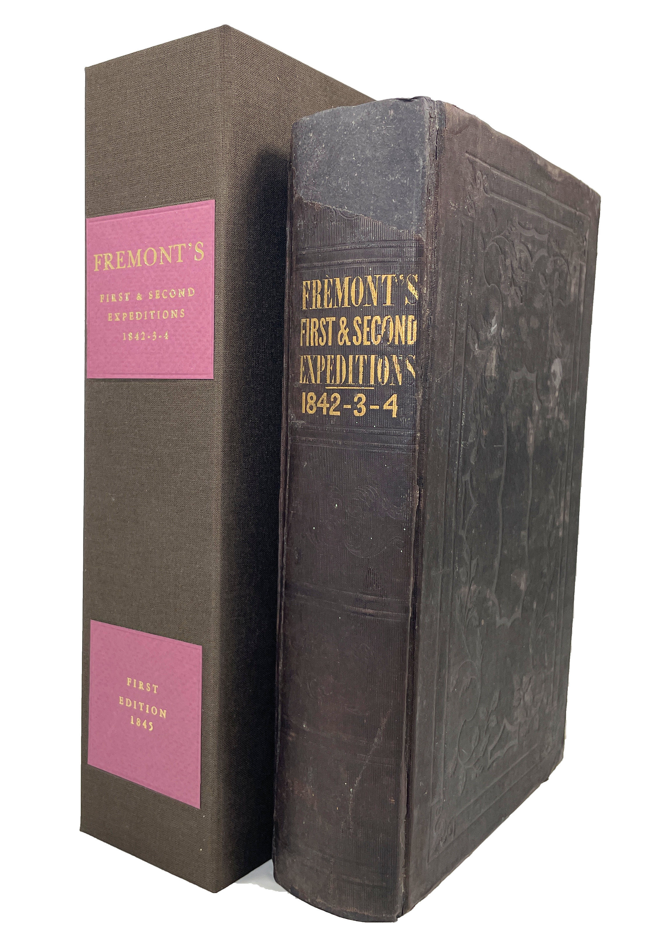
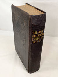
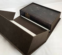
Washington DC: Gales and Seaton, 1845. First Edition. Clamshell case. Very Good. 8vo [9.25x6in, 22.5x14.5cm] 693 pp., four maps (two fold out) and large Preuss map (rear pocket), 22 plates of illustrations; Original binding, dark brown decorative embossed cloth covers with map pocket and ribbon at rear, all edges trimmed; Shelf wear to covers, edges and corners, some rubbing and spots to covers, repairs to joint splits and spine, some age toning, soiling and scattered spots to pages, archival repair to Preuss map closed tears, repaired map pocket with new ribbon, with custom clamshell/dropspine box, ink gift inscription to prior owner, healdic bookplate of subsequent prior owner one Alexander Ramsey Thomas on front paste down. [Wagner-Camp82 115:1, Howes F370aa, Hill 640, Best of the West 86, Zamorano80 39, Wheat Trans-Miss 497, Wheat Gold Region Maps 21, Rittenhouse 229]. John Charles Frémont (1813-1890) was an American Army officer, explorer, politician, California's first Military Governor, a Sierra Foothills land owner, and conducted mining operations. Today he is known as the "Pathfinder" for his exploration and surveying of the west. He began his military career in the Army Topographical Engineers in 1838, and was assigned to a three year survey of the upper Mississippi, Missouri and Des Moines rivers. In 1842, control of the Oregon territory was shared with the British with a vague border. With increased emigration to the Pacific Northwest, Frémont was sent on his first expedition in 1842 to survey the route west to the from the Mississippi to the northwest regions of Wyoming (the Oregon trail). In 1843, he was sent on his second expedition to the Columbia River, and to survey the routes and gather more information on the Oregon and Pacific Northwest terrain, people and conditions. Frémont then continued into Mexican held Nevada and Northern California to explore routes through the Sierra Nevada Mountains to the displeasure of the Mexican government.
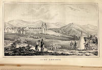
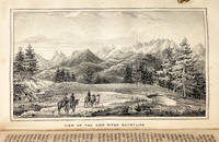
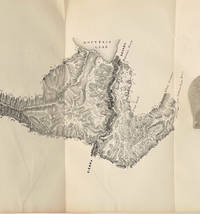
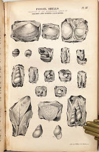
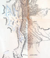
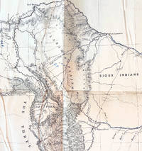
This 1845 Senate report covers the First and Second expeditions that made Frémont well known and set him on a path of further explorations, adventure and adding to the history of the west and California. The maps are; (1) Bear River p.132 foldout, (2) Beer Spring p.136, (3) Great Salt Lake p.155, (4) Crossing Sierra Nevada at South Fork of American river p.246 foldout, (Rear Pocket) Exploring Expedition to the Rocky Mountains in the year 1842, Oregon and Northern California 1843-44 [30x50.5in, 76.5x128 cm]. The 22 plate illustrations all present.
From Wheat, Mapping the Transmississippi West, "[Fremont's report and map] changed the entire picture of the West [and] represented as important a step forward from the earlier western maps of the period as did those of Pike, Long, and Lewis and Clark in their day ... [Fremont's map] represented trustworthy direct observation ... in the myth-encrusted cartography of the West." [From Volkmann Zamorano 80 catalogue].
In the 1845, the third expedition to the west, Frémont was to explore the Great Basin region and then on through California to the Pacific coast. Frémont also had secret orders in case of war with Mexico over territorial boundaries. In 1846, he was ordered to take control of California and proceed to support the Sonoma American settlers in the short lived Bear Flag Republic revolt. Commodore Stockton and Frémont then pursued the war to secure California.
Charles Preuss (1803-1854) was born in Prussia and came to America as a surveyor and cartographer. Frémont hired a number of civilians (mountain men, trappers, guides and Native Americans) to assist in his expeditions, and hired Preuss for three of his five expeditions to the west. Preuss was not cut out for extreme and long term "field work" of the expeditions, and wrote of his discomfort and concerns with Frémont in his diaries, which were discovered 100 years later in Germany. The maps in this report were sketched by Preuss, and the large surveyed map of the west served as a base map for Preuss' 1848 -additions and enhancements.
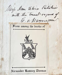
The ink inscription of "..?.. Ann Eliza Ritchie with the truest regard of E. A. Hannegan" is undated and research has not been able to clearly identify the people or connections. E. A. Hannegan may be the one-term U. S. Senator from Indiana in 1845, however there does not seem to be a connect with a possible Canadian Ritchie at the time.
The bookplate of Alexander Ramsey Thomas (1883–1946) dates from the early 1900s. Thomas was an avid and long-standing book collector, continuing the bibliophilic tradition of his father, Arthur Lloyd Thomas (1851–1924). Arthur Lloyd Thomas served as the 14th Territorial Governor of Utah from 1889 to 1893 and, following an unsuccessful gubernatorial election, was appointed Utah Postmaster, serving from 1898 to 1914. He assembled a collection focused on western expansion, exploration, and the study of human development and civilization. Alexander Ramsey Thomas became an attorney and relocated to Mendocino County, California in 1913 to establish his law practice, later serving as an officer of the courts.