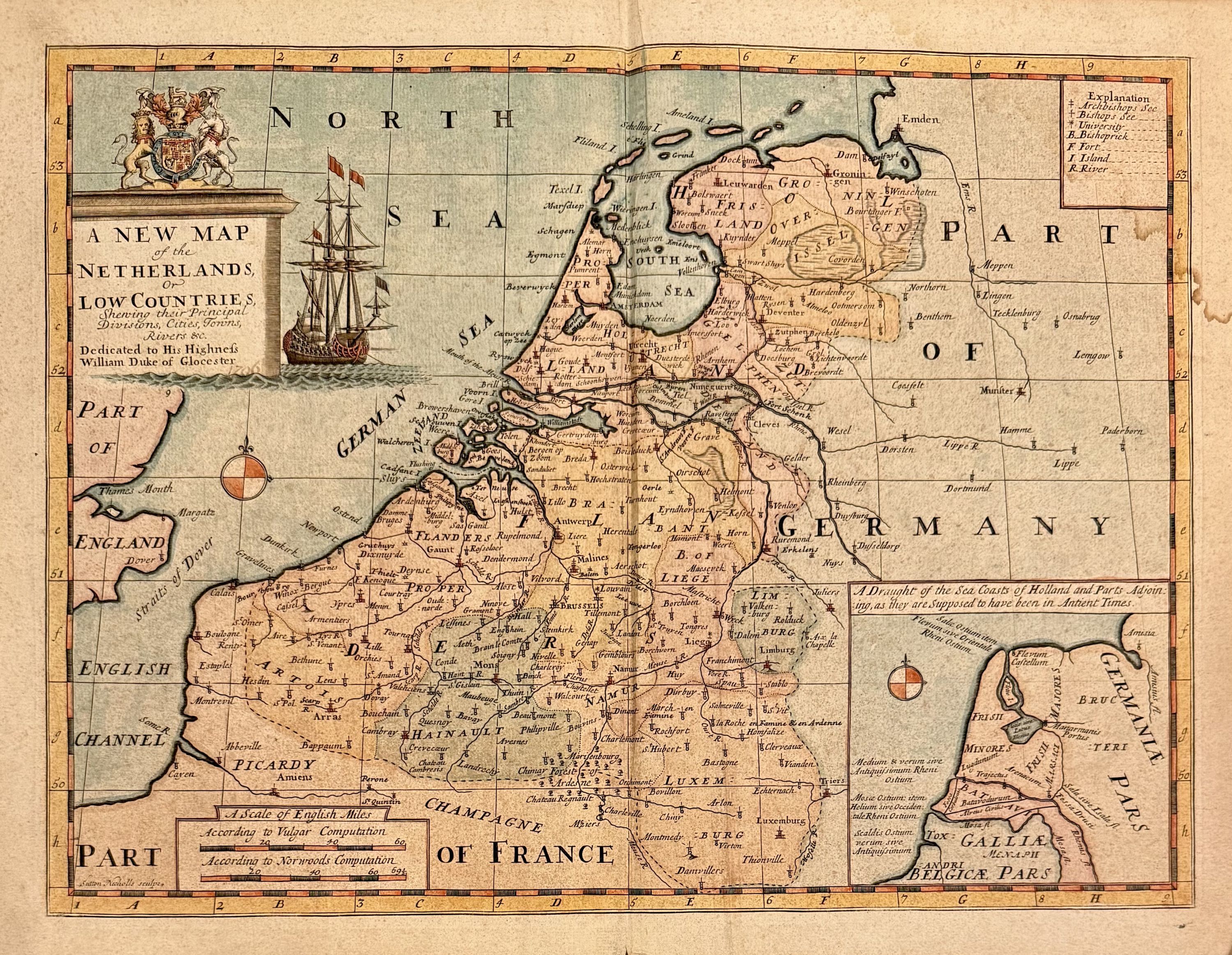
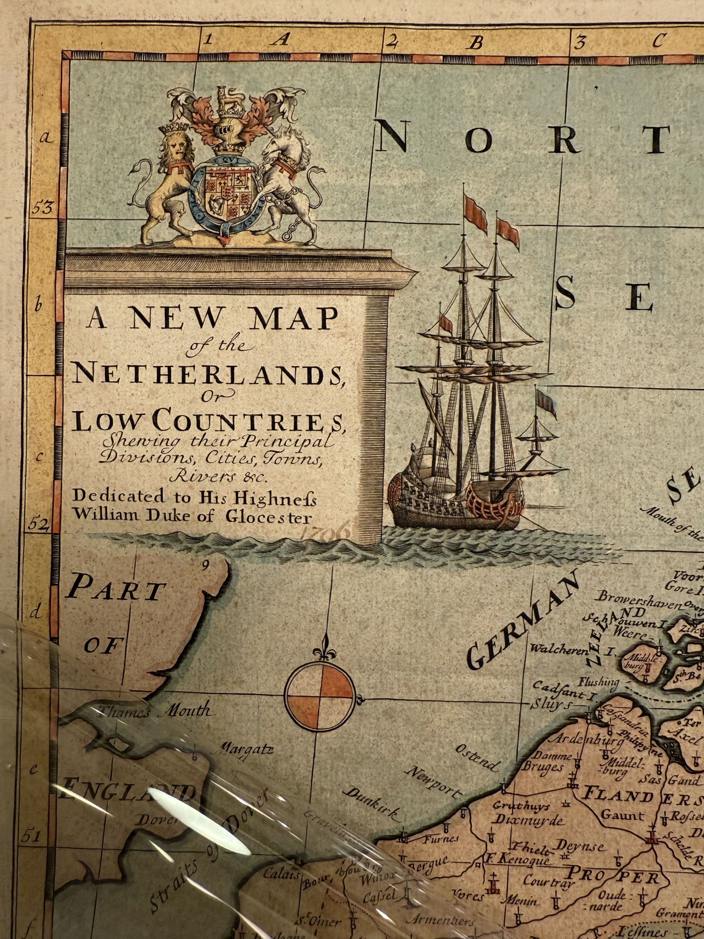
A New Map of the Netherlands, or Low Countries
- unbound
- Oxford: Edward Wells, 1700
Oxford: Edward Wells, 1700. unbound. Sutton Nicholls. Map. Hand colored. Image measures 14.5" x 20".
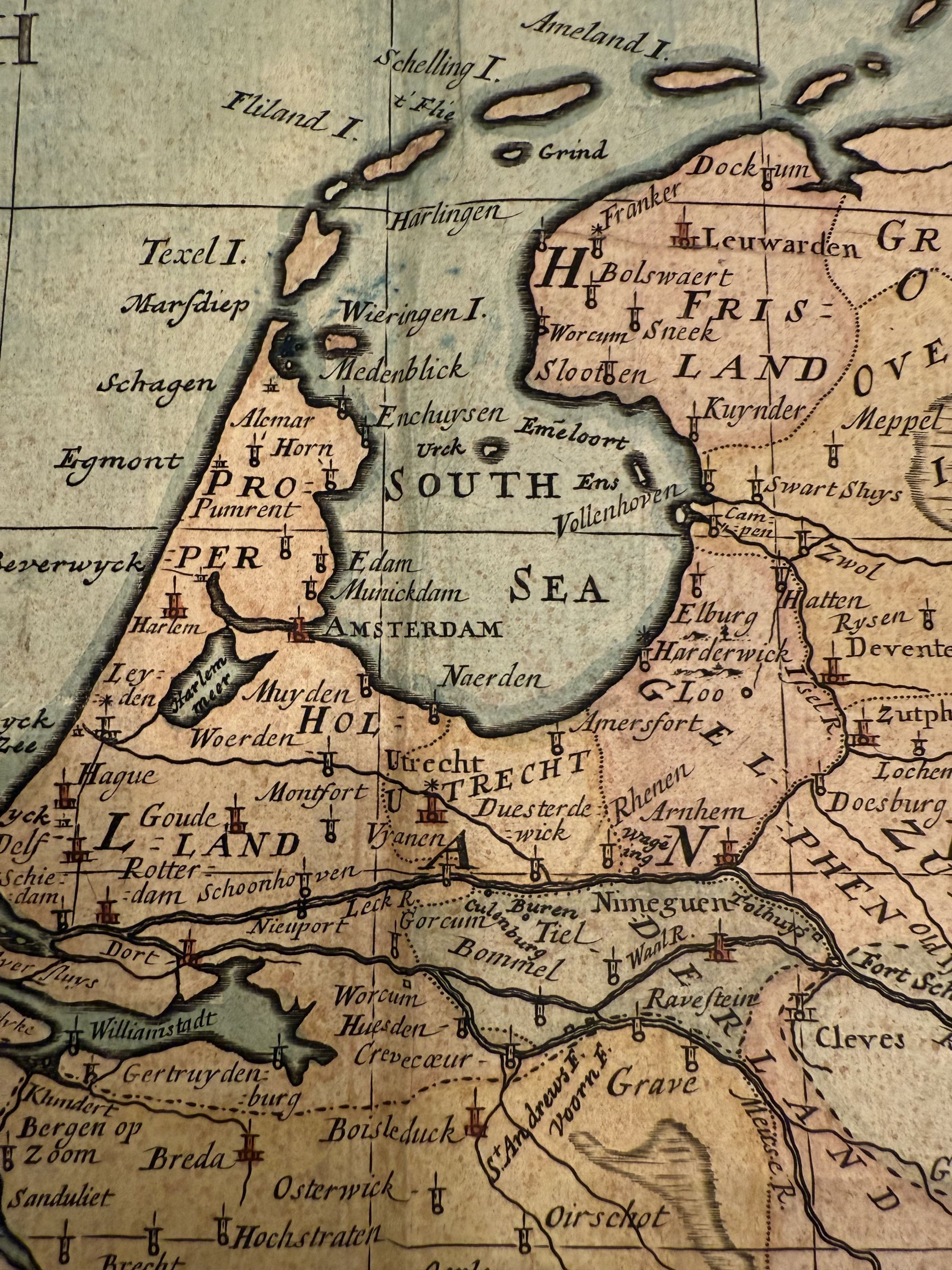
Simplified early 18th c map of the Low Countries and including Netherlands, Belgium and Luxembourg, created by Edward Wells.
An inset map in the lower right names the ancient tribes that settled in the area.
The map includes a decorative cartouche with the Duke of Gloucester's coat of arms, reflecting Wells' dedication to Prince William, Duke of Gloucester, who was a young Oxford student at the time. This map was part of Wells' atlas, "A New Sett of Maps both of Ancient and Present Geography," known for its geographical accuracy and strong engraved images. In good condition with minor staining and foxing.
Edward Wells (1667-1727) was an English mathematician, geographer, and classical scholar affiliated with Christ Church College, Oxford. Originally training for the ministry, Wells found his calling in academia, where he authored numerous works on mathematical and scientific topics. He tutored Prince William, son of Queen Anne, to whom he dedicated many of his maps, likely posthumously, as the prince died in 1700 before the publication of Wells' atlas. Wells' atlas, "A New Sett of Maps both of Ancient and Present Geography," was popular and went through several editions into the 1730s. Instead of focusing on grand decoration, perhaps Wells used a simpler approach for educational purposes. His maps were valued for their accuracy and aesthetic appeal. This is a beautiful example of his work.