China
- SIGNED unbound
- Edinburgh: John Thomson, 1829
Edinburgh: John Thomson, 1829. unbound. Map. Engraving with original hand coloring. Image measures 22.5" x 19.75".
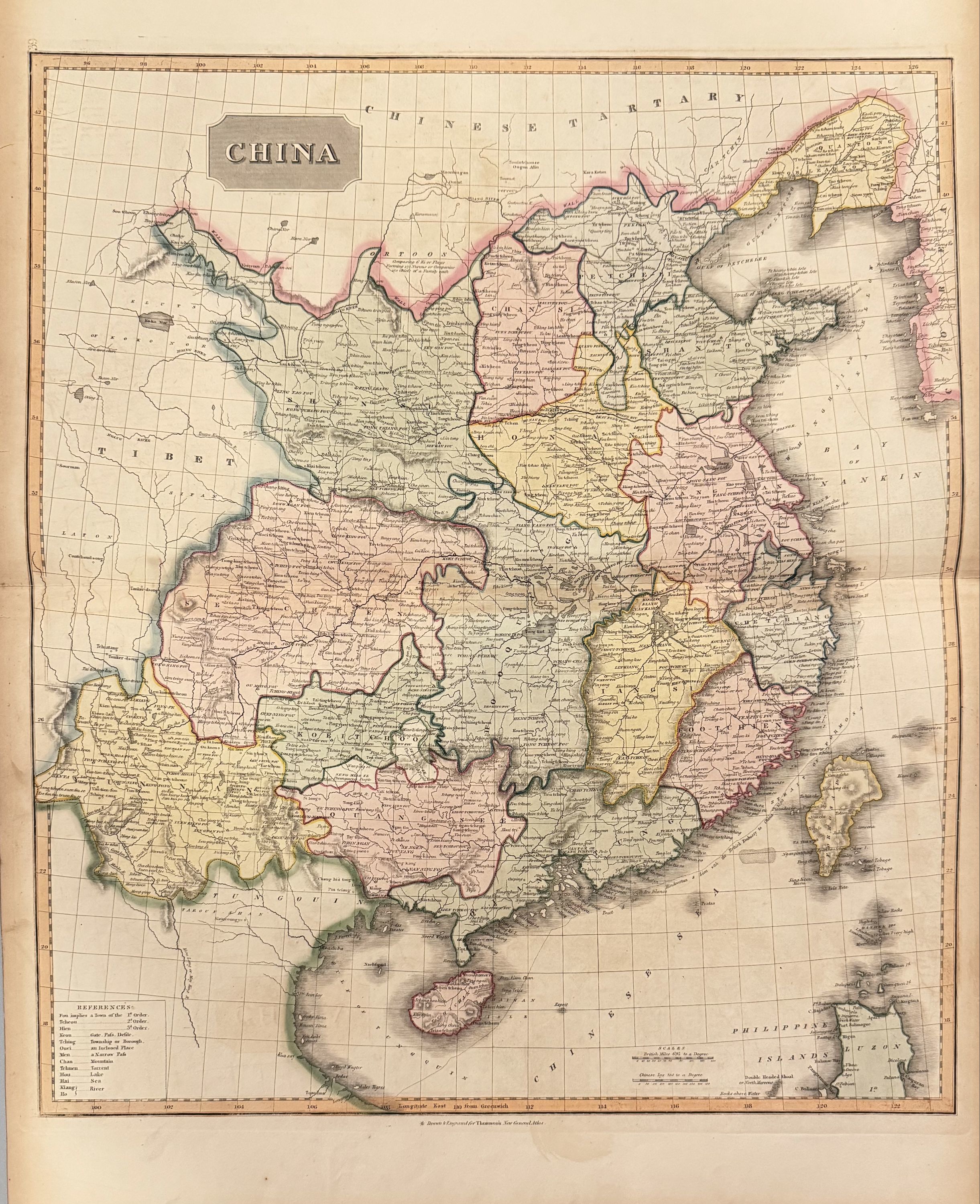
This impressive map of China was issued in 1817 by John Thomson. It covers all of China including the misshaped island of Formosa or Taiwan. Like all of Thomson's maps, this map notes numerous towns, cities, rivers and other topographical features with vivid color and detail. The Great Wall of China and the Grand Canal are both identified. Notes the "Barrier of wooden pikes dividing the Province of Quantong or Leaotong from Tartary.
The map also notes the route of the Royal Navy battleship H.M.S. Hindoostan and H.M.S. Lion with the British Embassy to China. The Macartney Embassy was the first British envoy sent to China to meet with the Qianlong Emperor and to ease trade restrictions between the two nations. Although the mission was unsuccessful, it did bring back better knowledge and understanding of the great empire.
The map is in good condition with minor wear along the original centerfold and minor offsetting. Some foxing. Original plate mark is visible.
John Thomson (1777 - 1837) was a Scottish bookseller and publisher active in the early 19th century, who was one of the leaders in Europe who favored detailed and accurate mapping over the decorative and elaborate cartouches that appeared in earlier maps. His most important work was "Thomson's New General Atlas" and his "Atlas of Scotland". Although he went into bankruptcy twice during his career, his maps are today highly desirable for their scale and detail. This is beautiful example of his work.