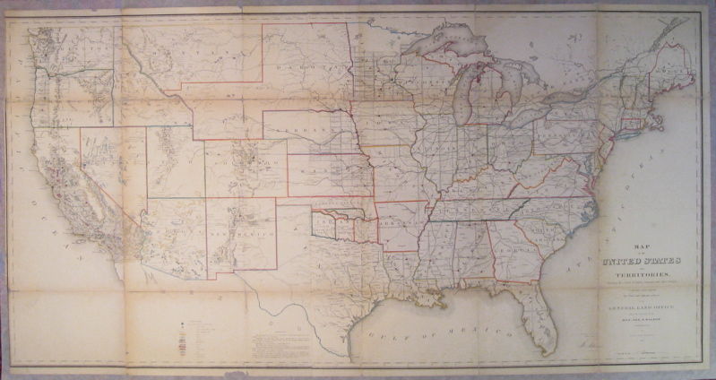
Map of the United States and Territories. Shewing the extent of Public Surveys and other details constructed from the Plats and official sources of the General Land Office


- unbound
- Washington D.C.: General Land Office, 1866
Washington D.C.: General Land Office, 1866. unbound. very good. Case map. Lithograph with original hand outline color. Image measures 28 7/8" x 55 7/8".
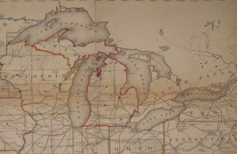
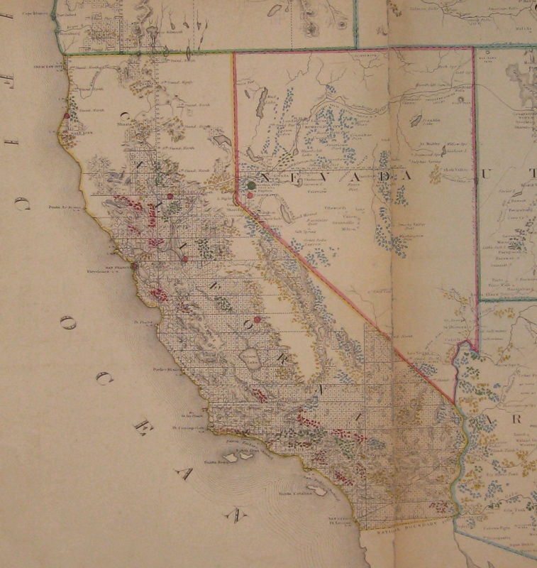
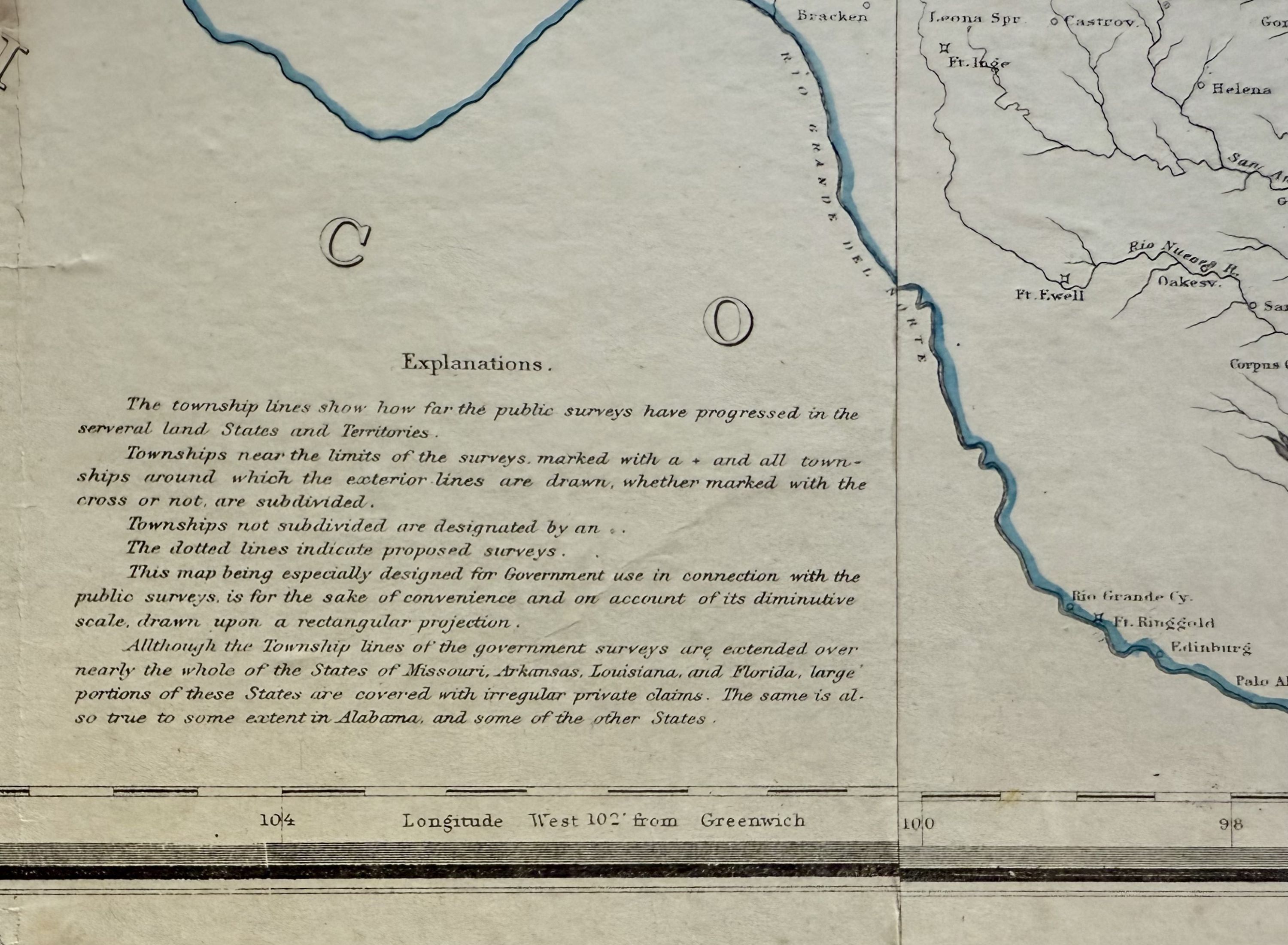
Large format map of the United States meant to accompany the Commissioner's land survey report. Map illustrates the progress of the Public Land Survey and shows land states, territories, land offices, townships, cities, forts and Indian Reservations and 'leased Indian lands.' Wyoming Territory is not yet named. Also shown are extensive geological details (color coded), topographical details, wagon trails, railroad lines and proposed rail lines. Scattered chips to edges and losses along original folds. All losses and tears have been professionally repaired. Lined with Japanese tissue. Left edge slightly cropped. Booklet missing.
Large format map of the United States meant to accompany the Commissioner's land survey report. Map illustrates the progress of the Public Land Survey and shows land states, territories, land offices, townships, cities, forts and Indian Reservations and 'leased Indian lands.' Wyoming Territory is not yet named. Also shown are extensive geological details (color coded), topographical details, wagon trails, railroad lines and proposed rail lines. Scattered chips to edges and losses along original folds. All losses and tears have been professionally repaired. Lined with Japanese tissue. Left edge slightly cropped. Booklet missing.