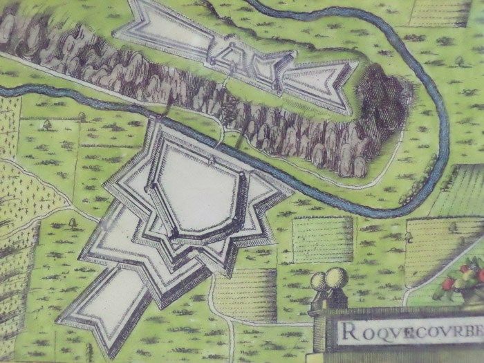
Hand Colored 1636 Print, Map of Roquecourbe, from 'Les plans et profils de toutes les principales villes et lieux considerables de France
- [Tavernier], 1636
[Tavernier], 1636. Print. Near Fine. Matted and ready for framing. Untrimmed. An exceptional example of a scarce print. A 7 x 9 3/4 sheet professionally matted down to 4 3/4 x 6 3/4 (mat measures 8 1/2 x 10 5/8). Beautiful modern hand coloring added. Labeled 44 in the upper right-hand corner. Roquecourbe is a region in south central France. The print shows a unique two-part fortification positioned on both sides of a natural waterway. The larger part borders on the south, with a bridge gatehouse leading to the main road. The northern portion sits atop a plateau linked to the main road by a winding stair. Attacking forces attempting to storm the main gate would be caught in a pincer attack between the two fortresses. The limited space between river and plateau would put them at even more severe a disadvantage by reducing troops to a narrow column. The shapes of the walls illustrate the star-shaped patterns common to this era, an adaptation made to allow for defensive canonry, and to protect against siege artillery.