Map of Arizona and New Mexico
- Philadelphia , 1870
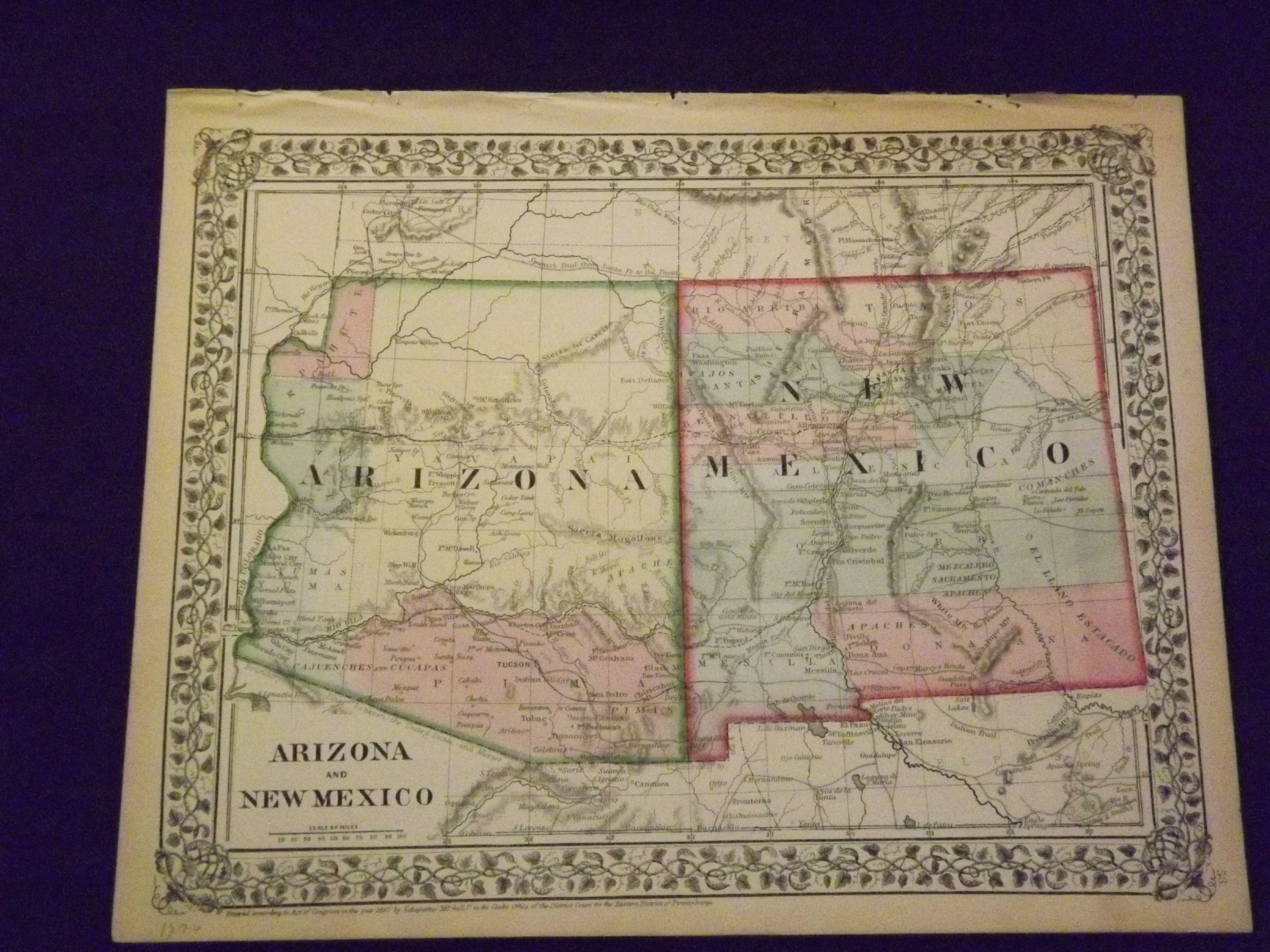
Unbound, colored engraved map, decorative boarder, 14 "x 11". Slight toning and aging, a few small chips in margins; overall bright and clear and in very good shape. Maps are wrapped with acid free board, or in rigid sleeves. The Mitchell family started to produce atlases in 1846, and continued into the early 1890s. Around 1860, S. Augustus Mitchell Jr. took over, and the atlas would be called Mitchell's New General Atlas. This is a bright and attractive map of two western states from the 1870 installment of that atlas. A little of the Colorado river can be seen, and the Apache Territory is featured in this map. Ristow 311-313