Map of the United States and Territories
- Philadelphia , 1865
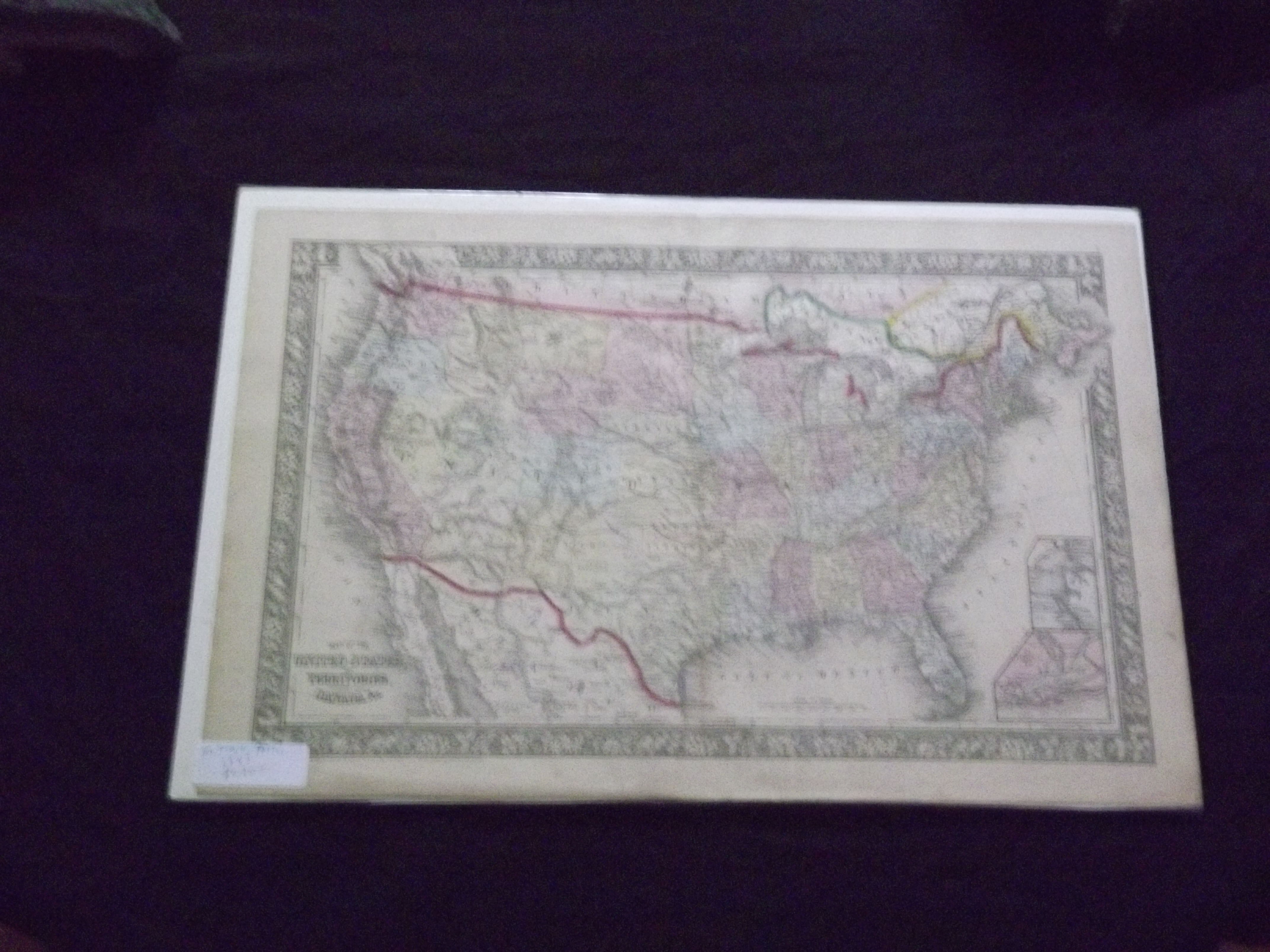
Philadelphia, 1865. Unbound, colored engraved map, decorative boarder, 22 1/2"x 14 1/2". Slight toning and aging; overall bright and clear and in very good shape. Maps are wrapped with acid free board, or in rigid sleeves. The Mitchell family started to produce atlases in 1846, and continued into the early 1890s. Around 1860, S. Augustus Mitchell Jr. took over, and the atlas would be called Mitchell's New General Atlas. This is a colorful and attractive double page map of the United States from the 1865 installment. The Indian Territory is highlighted, and Pensacola Bay and Norfolk Harbor are illustrated in two small insets. May require extra postage. Ristow 311-313