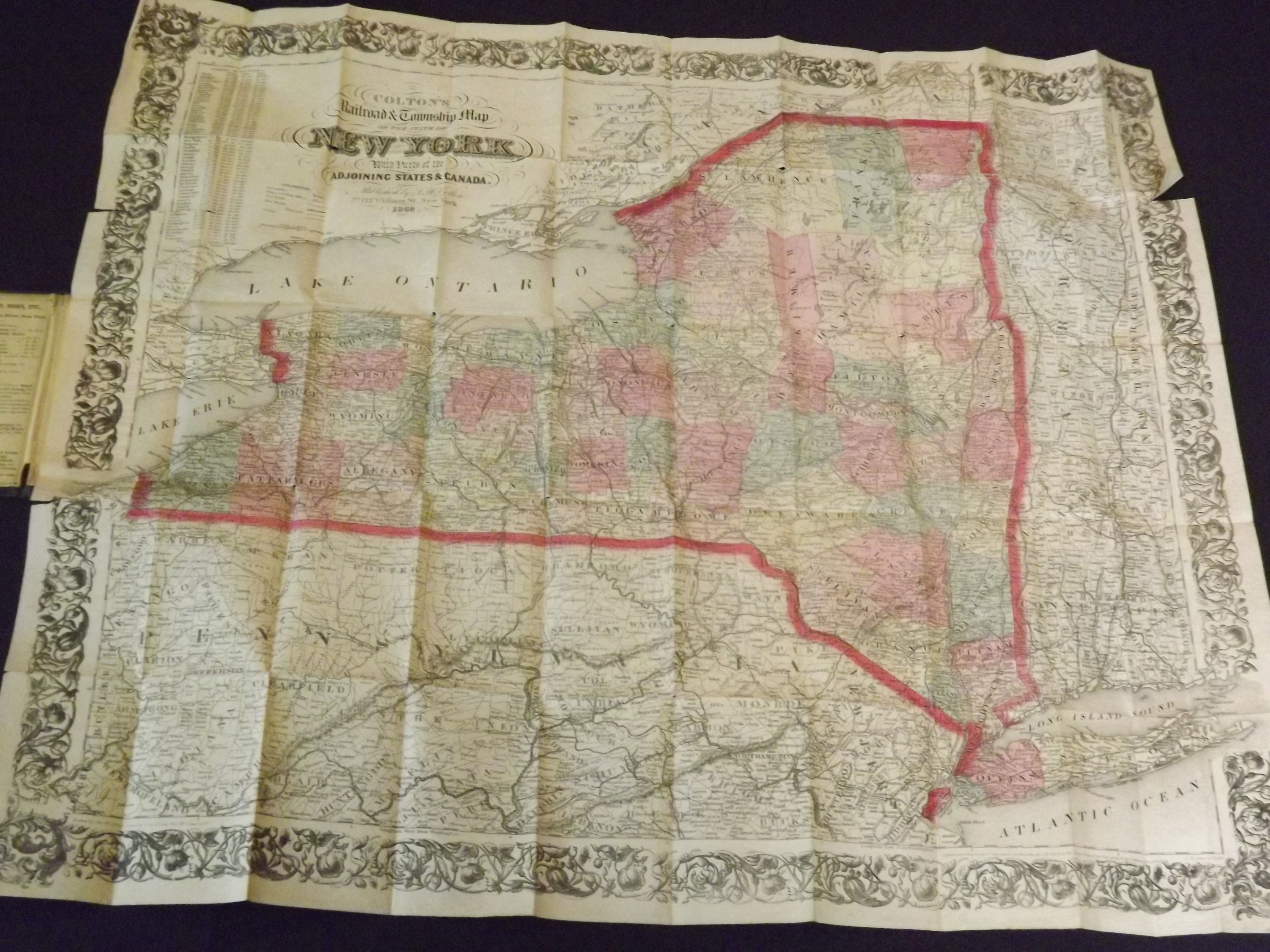
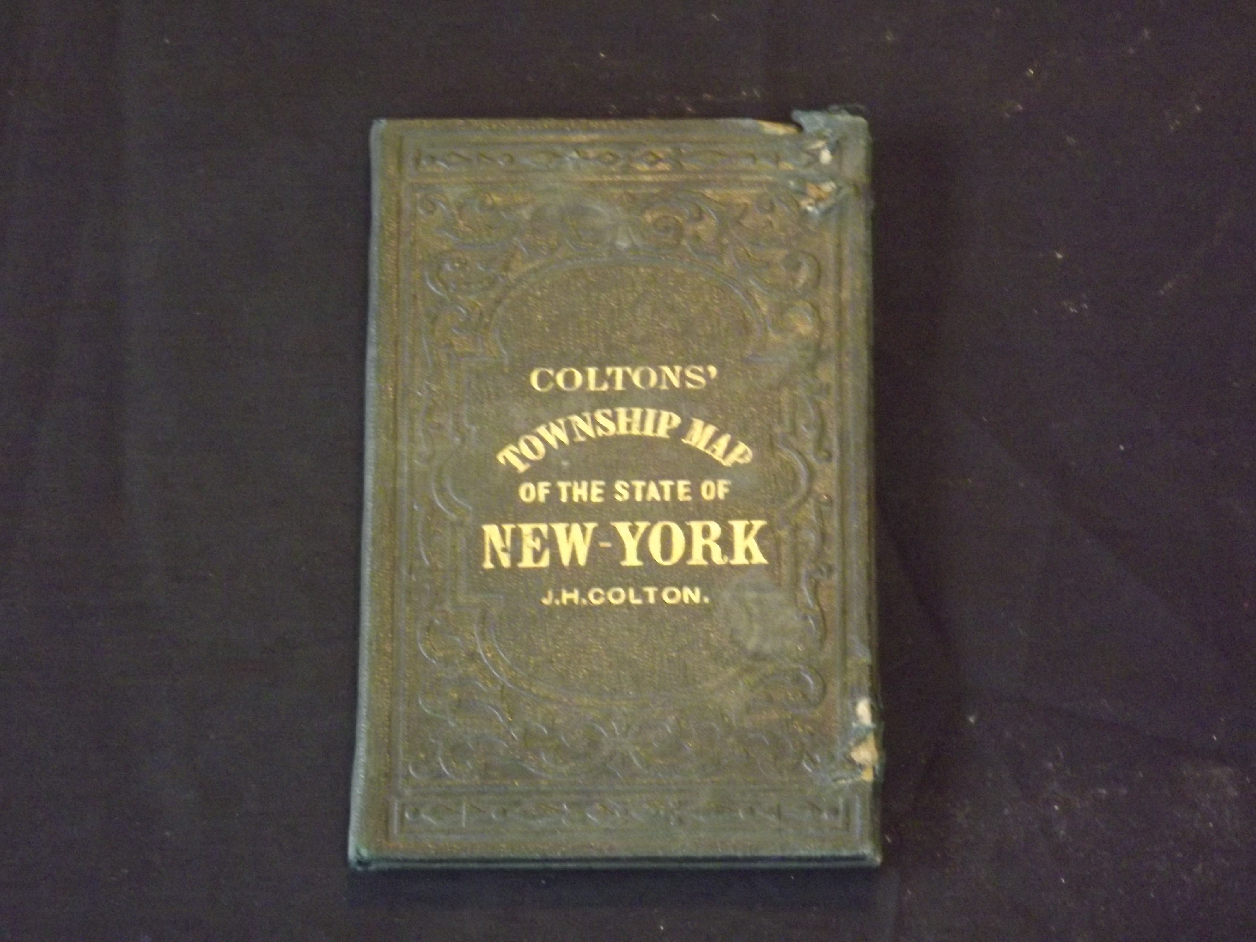
Colton's Township Map of the State of New York.
- New York: , 1860.
Folding map, cloth binding (3 1/2" x 6"). Gilt lettering, hand colored folding map, about 24"x 29". Binding with some edgewear and slight tears, but cover is generally bright, clean, and firm, a 4" tear going through the left margin, but not really affecting image, a 1 1/2" tear in right margin, not affecting image, a couple of tiny holes at fold; otherwise nice and clean and in very good condition. J.H. Colton ((1800-1893) founded a map making dynasty that began in New York in the early 1830s. Colton produced his maps with steel engravings, resulting in good quality. During 1833-1855 Colton would produce a large number of very popular guidebooks and railroad maps. In 1855 he published his first large atlas, and his firm would publish atlases for many years. This very detailed map of New York presents every town in the state, and has the attractive boarder, which was a trademark of Colton maps. geographicus website.