Abrege Geographie Universalle…
- Paris: , 1840.
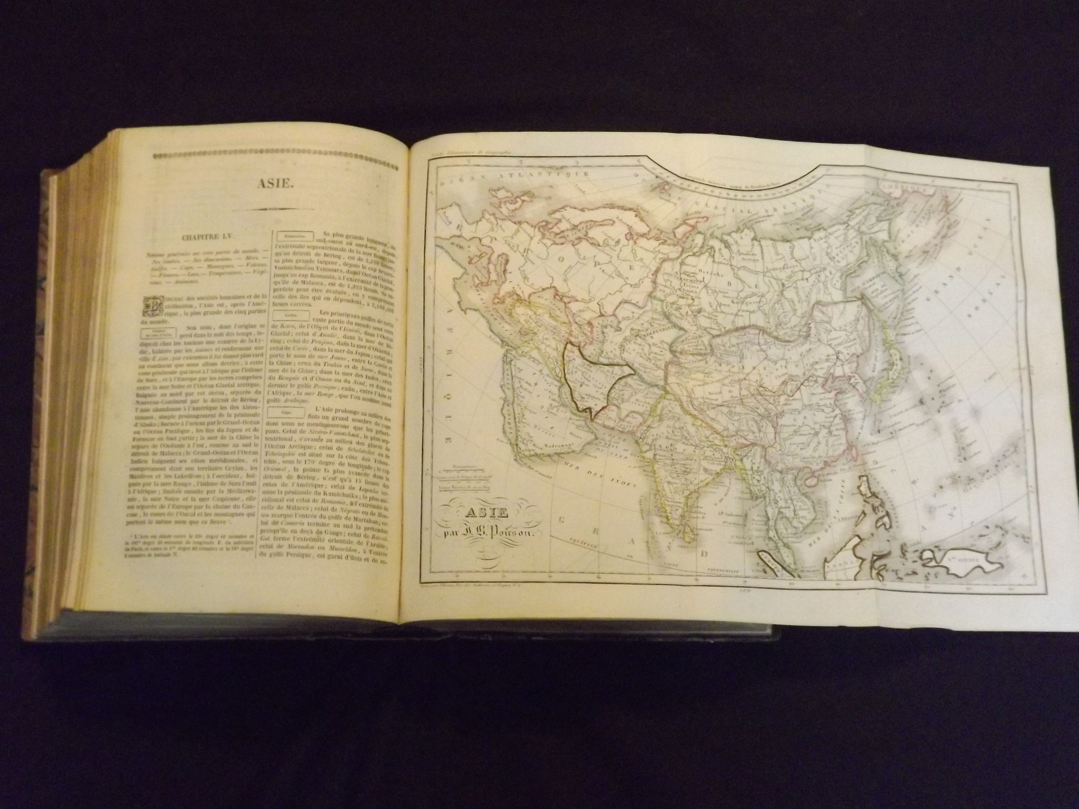
4to, leather spine and boards, illustrated with 25 engravings and 12 folding maps and charts, 1045, [1] pp. Binding worn at joints and edges, covers a bit worn and rubbed too, some plates show a good deal of foxing, but maps are generally bright and clean, but may not be bound in correct order; overall very good. This work includes 25 steel engravings of important places in Europe, including Naples, Rome, Paris and Amsterdam. There are also 12 attractive folding maps and charts, colored in outline. Maps of Europe, France, North America, South America, Asia, Africa and the Ancient World are included.