Carte de la Partie Nord des Etats Unis de L' Amerique Septentrionale.
- [Paris]: , c1780.
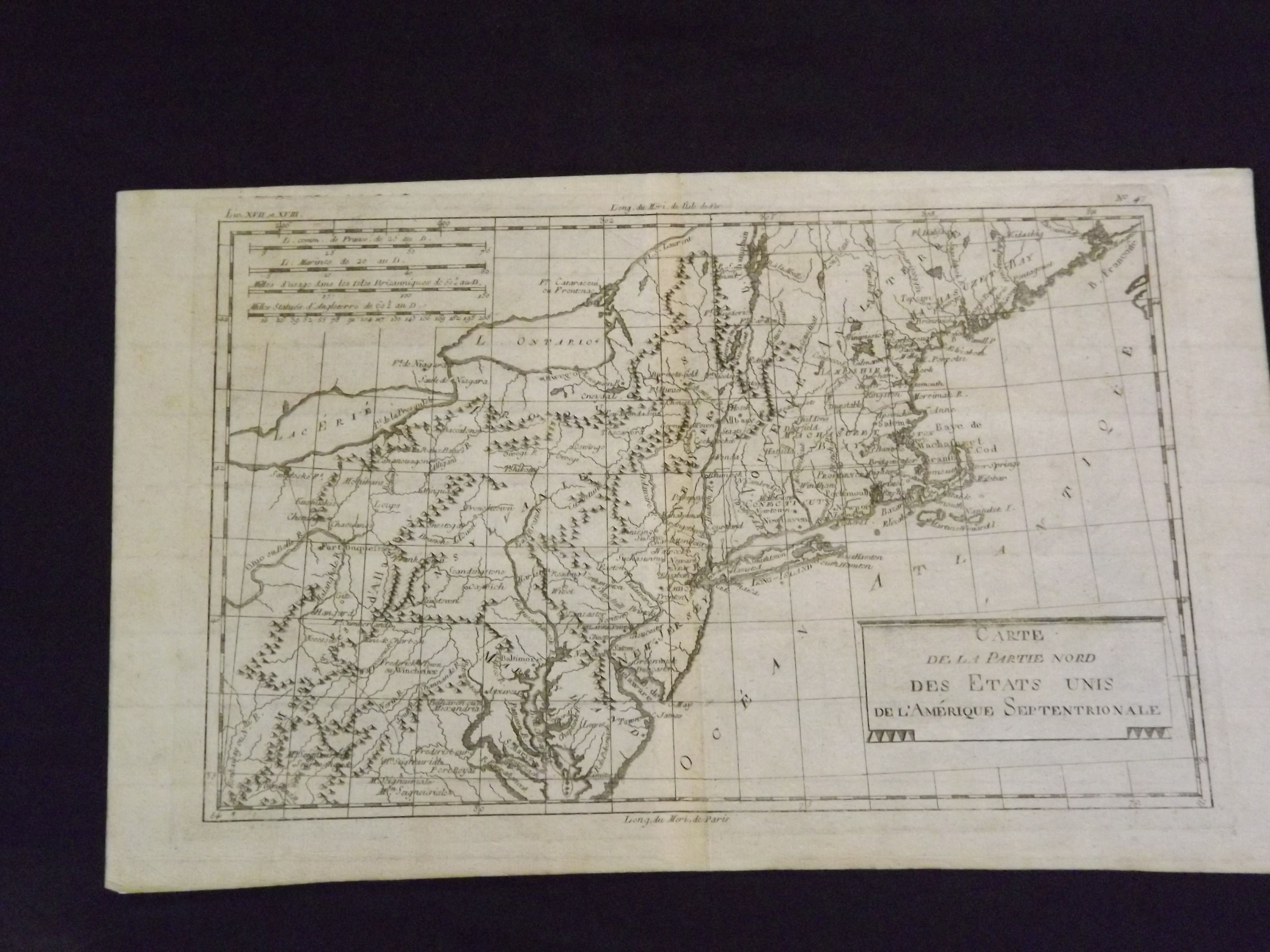
Engraved map, uncolored, straight boarder, plain cartouche, 32 x 21.6cm (121/2" x 81/2"). Light toning and browning at the fold, and a bit of faint foxing; nice crisp impression and very nice overall. Boone appears to have composed maps for Raynal's Historire Philosphique, which was published in Dutch, English, French, German and Italian editions. His maps were also published in Grenet's Atlas Portatif, published in 1781 (as well as later editions), and Atlas Encylopedique (1787-88). This is essentially a map of the eastern United States, showing the coast line from Massachusetts to Maryland. According to Tooley, his maps of the Great Lakes (some of which can be seen on this map) has greater circulation than any other small maps of the region in the later part of the 18th century. Tooley: The Mapping of America p. 318.