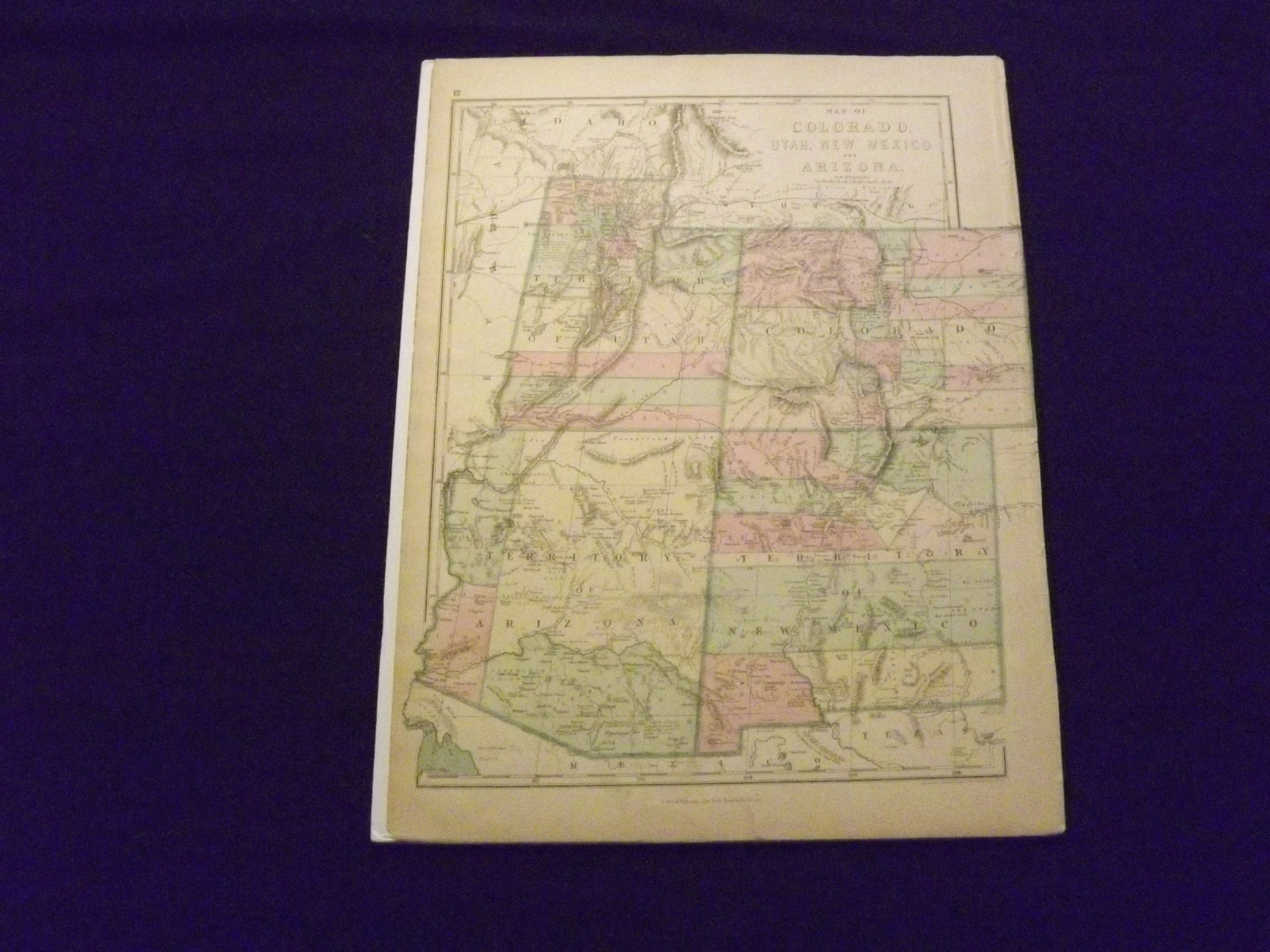
Map of Colorado, Utah, New Mexico, and Arizona.
- New York, Boston & Chicago, : J. David Williams,, [1873].
Large (14" x 20") colored map, margins are ample. Normal browning and aging, a little finger soiling, some very minor folds and chips at the extremities; otherwise very good. This is an attractive colored map of the Western States from The People' Pictorial Atlas published in 1873. Utah, Arizona and New Mexico are not yet states, and are presented as territories.