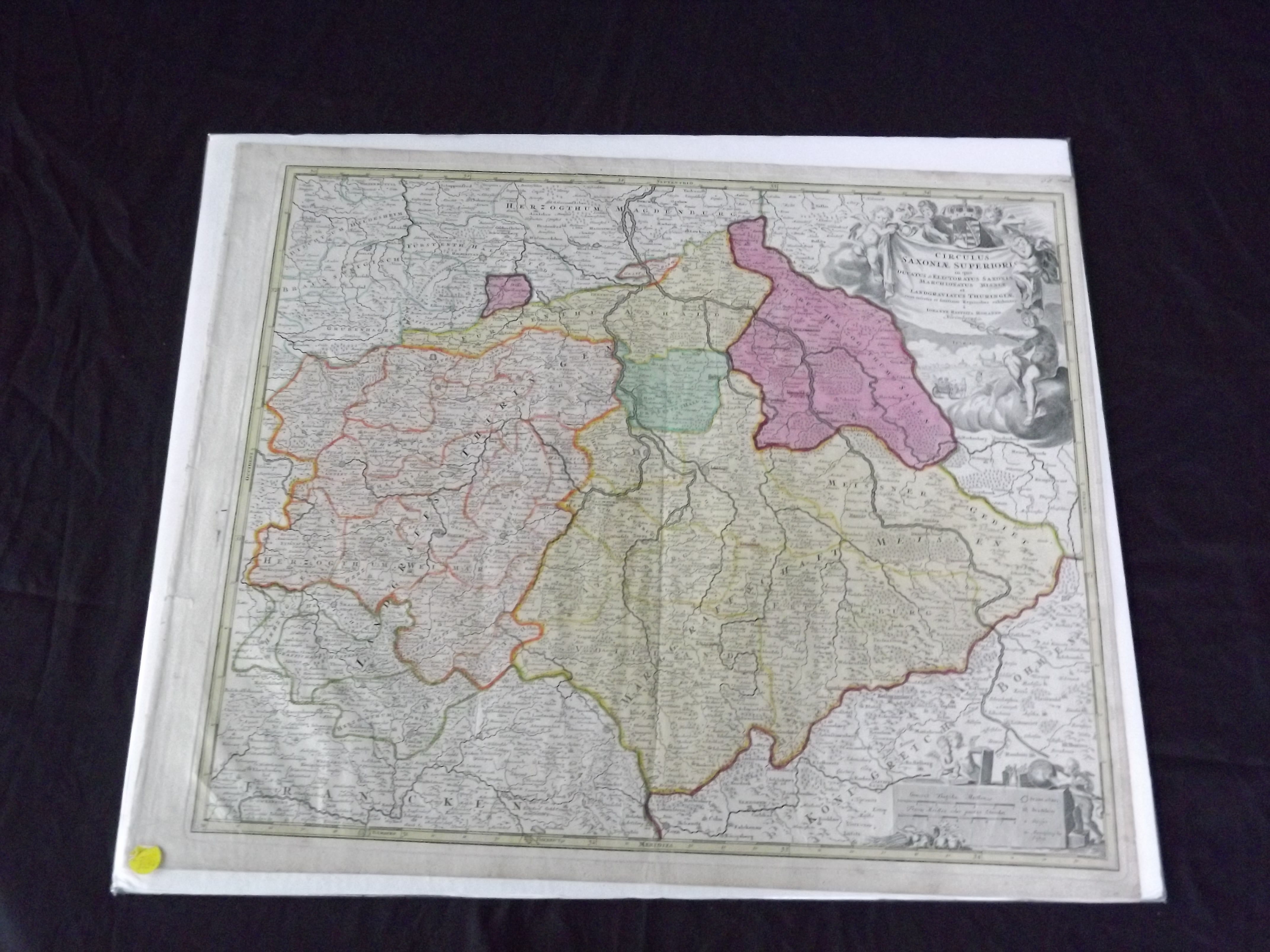
Circulus Saxonaie Superioris…
- Nuremberg: , c1730.
Engraved double page (24" x 20 "), partially hand colored, large title uncolored cartouche in upper right corner. Map has a couple of small holes, and a repaired tear on the top part of map, also some minor margin tears, slight aging and browning; otherwise very good with a strong impression. Johann Baptist Homann (1663-1724) was considered the father of German mapmaking, and in 1715 was actually appointed the Geographer to the Emperor. He founded his mapmaking business in 1702, and he would produce several major atlases between 1707 and 1716. This is an attractive map covering the Saxony and Thuringia regions, including Erfurt and Dresden, and many other towns and with considerable topographical detail. Van De Gohm: Antique Maps. Bagrow: History of Cartography.