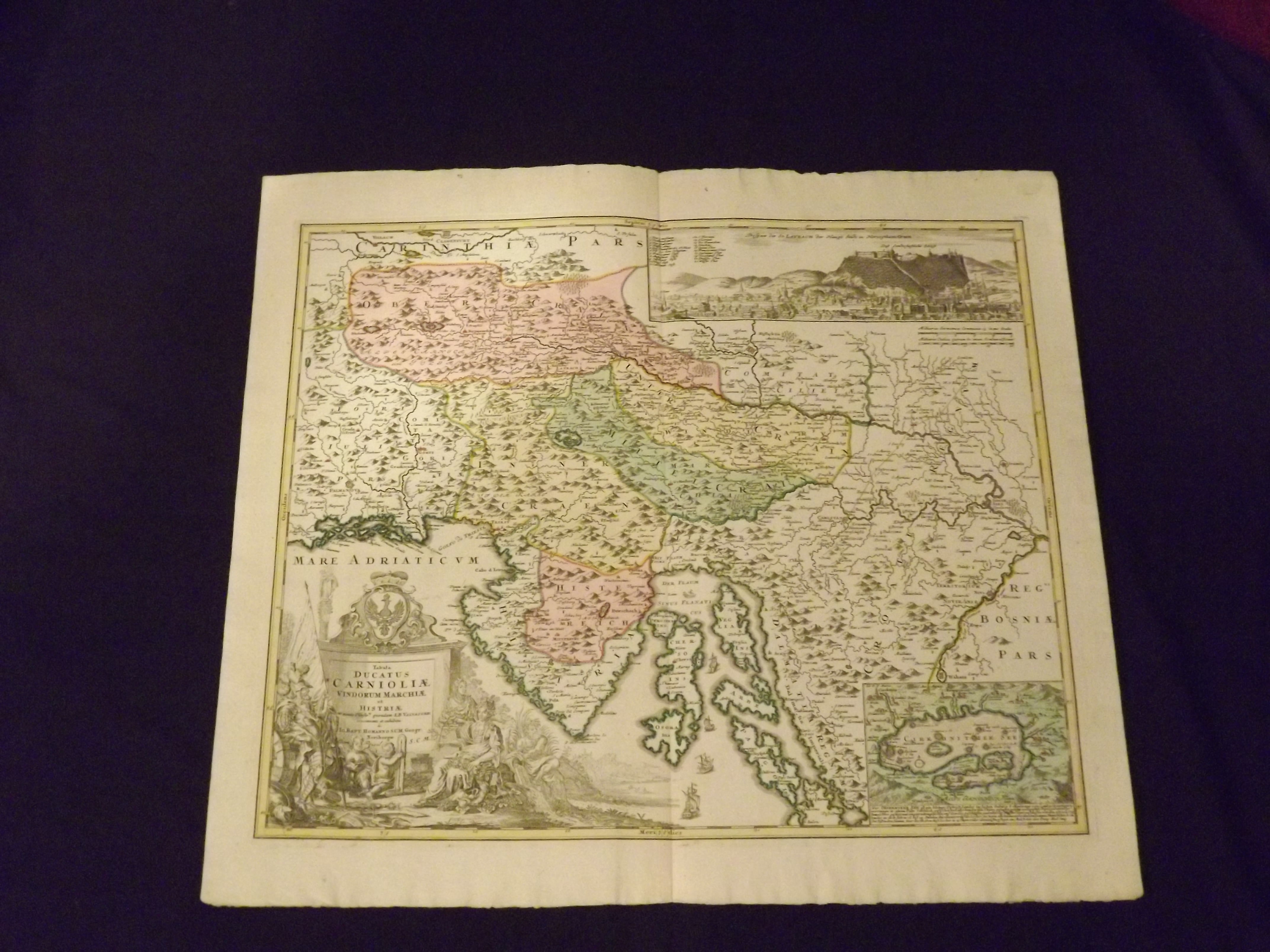
Tabula Ducatus Carnioliae, Vindorum Marchiae et Histriae…
- Nuremberg: , c1720.
Copper-engraved map, hand-colored; large uncolored pictorial cartouche. 48x57 cm (18¾x22½"). Slight edge creasing, and a little soiling; bright and clean and in near fine condition. Johann Baptist Homann (1663-1724) was considered the father of German mapmaking, and in 1715 was actually appointed the Geographer to the Emperor. He founded his mapmaking business in 1702, and he would produce several major atlases between 1707 and 1716. Striking map of Slovenia and Croatia with good detail of towns and the topography. A large inset at top contains a panoramic view of Laybach (Ljubjana), and a smaller inset at bottom shows Cirehnitzer See (Lake Cerknica) in southwestern Slovenia. The figurative title cartouche features putti, Cybele with her turreted headpiece, a river god, and the Carniola coat of arms. There are ships sailing the Adriatic Sea. Van De Gohm: Antique Maps. Bagrow: History of Cartography.