Tabula Aquitaniae complectens Gubernationem Guiennae et Vasconiae.
- Nuremberg: , c1730.
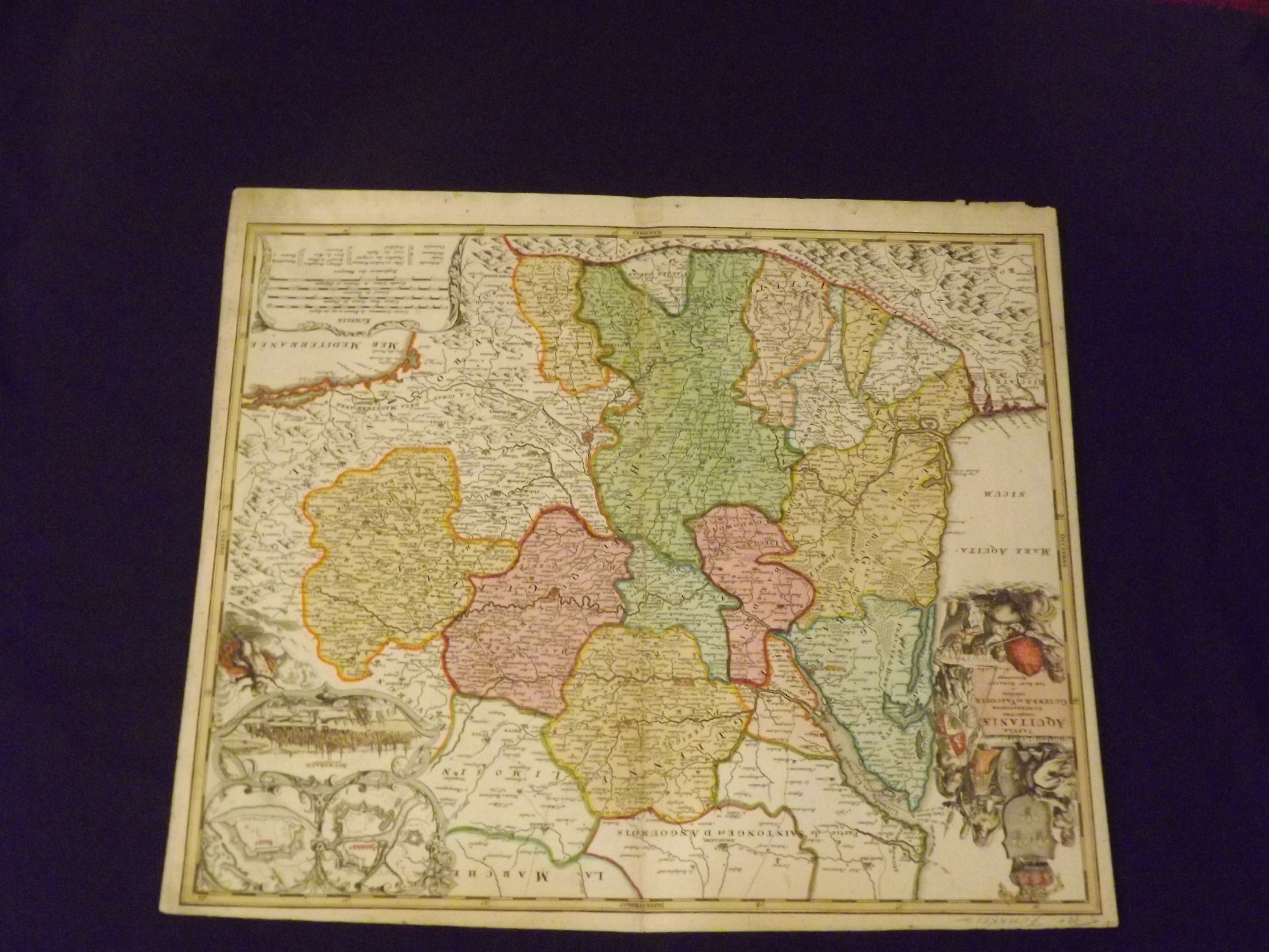
Copper-engraved map, hand-colored. 48x57.5 cm (18¾x22½"). Soiling in margins, pencil notation on top margin, some chipping along margin, a bit of wear along centerfold with repair on verso, marginal repair on recto; very good. Johann Baptist Homann (1663-1724) was considered the father of German mapmaking, and in 1715 was actually appointed the Geographer to the Emperor. He founded his mapmaking business in 1702, and he would produce several major atlases between 1707 and 1716. Decorative map of southeastern France, showing the mountains, forests, roads and cities. There is a large inset in a decorative border with fortification plans of Bayonne and Blaye, and a bird's-eye vignette view of the city of Bordeaux.The large title cartouche features figures of a soldier, Neptune, a queen, a maiden and the royal crest. Van De Gohm: Antique Maps. Bagrow: History of Cartography.